AlpES
Alpine Ecosystem Services – mapping, maintenance and management
Home
Outcomes
Overview
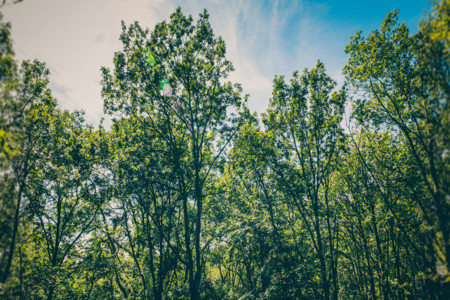
In October 2018, storm Vaia knocked down 42.000 hectares of woodlands in the Italian Alps. Several mountain villages suddenly found themselves under new avalanche paths as winter approached. Protection against snow slides is just one example of the contributions of ecosystems to human well-being, although they are often overlooked until it is too late. AlpES worked to raise awareness and involve stakeholders, but also to answer the need for information of many policymakers. To achieve this, the project partners gathered the policy tools available in the Alpine countries and harmonised the mapping and assessment of ecosystem services.
Factsheet
- 2014 – 2020
- Liveable
- Enhance the protection, the conservation and the ecological connectivity of Alpine Space ecosystems
-
- Group 6: To preserve and valorise natural resources, including water and cultural resources
- Group 7: To develop ecological connectivity in the whole EUSALP territory
- 12/2015
- 12/2018
- 2.265.507 EUR
- 1.829.886 EUR
Partners
European Academy of Bozen/Bolzano (Lead partner)
- Lead partner
- Italy
- Provincia Autonoma di Bolzano/Bozen
- Bolzano
- Caroline Pecher
- caroline.pecher@eurac.edu
University of Innsbruck - Institute of Ecology
- Austria
- Tirol
- Innsbruck
- Ulrike Tappeiner
- Ulrike.tappeiner@uibk.ac.at
Austrian Academy of Sciences - Institute for Interdisciplinary Mountain Research
- Austria
- Tirol
- Innsbruck
- Annemarie Polderman
- Maria.Polderman@oeaw.ac.at
Centre For Studies and Expertise on Risks, Environment, Mobility, and Urban and Country planning
- France
- Provence-Alpes-Côte d'Azur
- Aix en Provence cedex
- Patricia Detry
- patricia.detry@cerema.fr
Safe Mountain Foundation
- Italy
- Valle d'Aosta/Vallée d'Aoste
- Courmayeur
- Jean Pierre Fosson
- jpfosson@fondms.org
Veneto Region - Parks Biodiversity Forest Planning and Consumer Protection Section
- Italy
- Veneto
- Venezia Mestre
- Daniele Savio
- daniele.savio@regione.veneto.it
Piedmont Region - Environment, Energy and Territory Directorate
- Italy
- Piemonte
- Torino
- Maria Quarta
- maria.quarta@regione.piemonte.it
The Institute of the Republic of Slovenia for nature conservation
- Slovenia
- Zahodna Slovenia
- Ljubljana
- Nika Debeljak
- nika.debeljak@zrsvn.si
CIPRA International on behalf of the Principality of Liechtenstein, Office of Environment
- Liechtenstein
- Liechtenstein
- Vaduz
- Manon Wallenberger
- Manon.Wallenberger@cipra.org
Institute for Environmental Planning and Spatial Development
- Germany
- Oberbayern
- München
- Stefan Marzelli
- Stefan.marzelli@ifuplan.de
- 46.494530211.3472734
- 47.26793911.378443180594596
- 47.2633933511.345768875261214
- 43.52984245.4474738
- 45.81836236.9643506
- 45.478116912.2530442
- 45.07264717.6678075
- 46.048437514.4932309
- 47.1374092500000059.519122149999996
- 48.151034611.578677173342168
Outcomes
-
Final Publication. Ecosystem Services and governance in the Alps
StrategyTools and Tips for effective Environmental Management and Territorial Development. -
Ecosystem Services in the Alps: A short report
StrategyAs a basis for joint action, public authorities, policy makers, NGOs and economic actors need a common understanding of ecosystem services, comparable information on their status and support in using tools for integrating them in their fields of work.Ecosystems and their services go beyond national borders and need a transnational approach for their dynamic protection, sustainable use, management and risk prevention. As a basis for joint action, public authorities, policy makers, NGOs and economic actors need a common understanding of ecosystem services, comparable information on their status and support in using tools for integrating them in their fields of work. The document is available in all alpine languages on the project website. -
Alpine ecosystem services concept
StrategyThis booklet develops and fosters a common understanding of ecosystem services for decision-makers, public administrations and the public at large.This booklet develops and fosters a common understanding of ecosystem services for decision-makers, public administrations and the public at large. It introduces the concept, its opportunities, challenges and obstacles/bottlenecks, and also provides insights into what we know about ecosystem services in the Alpine area. Furthermore, it outlines how it can be implemented in day-to-day business activities. -
Film: What are ecosystem services?
StrategyIn this animation, researchers from Eurac Research and their partners explain what ecosystem services are.Throughout the past decade, the topic of ecosystem services has become extremely popular in research, resulting in a huge variety of definitions and terms. For example, ecosystem services are defined as benefits people obtain from ecosystems; or the direct and indirect contributions of ecosystems to human well-being. In this animation, we show you few Alpine relevant ecosystem services such as pure groundwater that we use as drinking water, Alpine grasslands and meadows that provide biomass, CO2 sequestration by Alpine forests, or recreation opportunities. -
Project observers
NetworkIn this file, you can find a list of the project observers. -
WIKIAlps – the Alpine WIKI
ToolSpatial development is a crucial issue in the Alpine Space where economy, society and environment have to coexist in a very confined space. Any small action taken in any of these fields can trigger big alterations in the others.In the same way, actions taken at local, regional or national level have consequences that affect other countries within the Alpine Space. A balanced and shared territorial development in all the Alpine Space countries needs appropriate, current and manageable information for a sound decision-making. Nowadays, the large and diverse amount of information available complicates the search for correct and useful pieces. The AlpES project partners are contributing towards streamlining information in the Alpine Space by making information and results publicly available through the WIKIAlps website. The WIKIAlps is accessible to the general public and everyone with expertise on Alpine Space topics is invited to share their knowledge by editing or creating new pages. By expanding the WIKIAlps with information related to the AlpES project, the website is strengthening its position as an important knowledge platform on the Alpine space. -
AlpES WebGIS
ToolPart of the AlpES project is the development of an interactive and interoperable AlpES WebGIS through which ecosystem services (ES) indicators and their metadata are made available.A geographic Information System (GIS) is a computer system designed to capture, store, manipulate and present spatial (or geographic) data. GIS can show many different kinds of data on one map, using any information that includes a location. In this way, people can compare different elements in order to understand how they relate to one another. In the case of the AlpES WebGIS, data that can be visualised on the map include the eight selected ES. In the WebGIS AlpES stakeholders can create their own ES maps and use these to inform themselves about the state of individual ES in their municipality or region. The WebGIS will be made available in the five AlpES project languages (EN, DE, FR, IT, SL) and linked to the alpine knowledge platform WIKIAlps.