Overview
In the Alps, rising temperatures and extreme weather events threaten streams and groundwater. These changes impact biodiversity and affect agriculture, hydropower, water supply, and tourism. To address these issues, WATERWISE co-designs and tests solutions for sustainable land and water management. The project raises public awareness about water vulnerability in the Alps, and provides guidance for improving water policies and territorial planning. Through these efforts, WATERWISE enhances the resilience of Alpine regions.
Factsheet
- 2021 – 2027
- Climate resilient and green Alpine region
- SO 1.1 - Promoting climate change adaptation and disaster risk prevention, resilience, taking into account eco-system based approaches
-
- AG6 Natural resources
- 2.692.120 EUR
- 1.613.790 EUR
Description
Climate change and human pressures are increasingly impacting mountain headwaters, the main sources of freshwater in the Alpine Space. Large alterations in water availability and quality pose significant challenges for Alpine communities and have profound implications for the ecosystem services on which they depend. WATERWISE aims to leverage recent advances in modelling techniques tailored to assess the vulnerability of headwaters to climate and land-use changes, and to make them accessible to local water and land managers. Through collaboration between scientists, communities and protected area managers, an innovative digital toolbox will be co-designed and tested in seven pilot sites. This toolbox, accessible via a user-friendly web-platform, will facilitate the collection, analysis and visualization of in-situ climatic and ecohydrological data, while also enabling headwaters vulnerability assessments.
The project will provide local stakeholders with the necessary scientific basis for co-designing robust and participatory management strategies, thereby enhancing the resilience of water resources, ecosystems and communities, in line with AS S.O 1.1(*) and the EUSALP cross-cutting priority Joint Water Management Transition.
Once validated, the toolbox will be implemented across a network of complementary sites covering the diversity of headwaters and challenges in the Alpine Space. End-users will be trained to operate and update the toolbox via the web-platform, ensuring its continued relevance and value beyond the end of the project.
Combined with educational materials, creative storytelling and public outreach events, the results of WATERWISE will raise awareness among Alpine communities about the vulnerability of headwaters ecosystem services. WATERWISE will strengthen the dialogue between scientific experts and policymakers and stimulate the joint development of transnational solutions to secure water resources in the Alpine region.
*SO 1.1: Promoting climate change adaptation and disaster risk prevention, resilience, taking into account eco-system based approaches.
Partners
- Lead partner
- Switzerland
- Espace Mittelland (CH02)
- Neuchâtel
- Clément Roques
- clement.roques@unine.ch
- Italy
- Provincia Autonoma di Trento (ITH2)
- San Michele all’Adige
- Monica Tolotti
- monica.tolotti@fmach.it
- France
- Bourgogne (FRC1)
- Dijon
- Florent Taberlet
- florent.taberlet@rnfrance.org
- France
- Rhône-Alpes (FRK2)
- Grenoble
- Raphaël Trouiller
- raphael.trouiller@tetraktys-ong.org
- Germany
- Niederbayern (DE22)
- Passau
- Terese Venus
- terese.venus@uni-passau.de
- Germany
- Karlsruhe (DE12)
- Karlsruhe
- Markus Noack
- markus.noack@h-ka.de
- Austria
- Tirol (AT33)
- Galtür
- Helmut Pöll
- kassa@galtuer.gv.at
- Slovenia
- Zahodna Slovenija (SI04)
- Ljubljana
- Nina Rman
- nina.rman@geo-zs.si
- Austria
- Kärnten (AT21)
- Bad Eisenkappel
- Gerald Hartmann
- gerald.hartmann@geopark-karawanken.at
- Italy
- Piemonte (ITC1)
- Torino
- Sergio Capelli
- sergio.capelli@legambientepiemonte.it
- Italy
- Lombardia (ITC4)
- Milano
- Matteo Fioletti
- m.fioletti@arpalombardia.it
- Switzerland
- Région lémanique (CH01)
- Sion
- Marie Arnoux
- marie.arnoux@crealp.vs.ch
- 46.98958286.9292641
- 46.193405911.1339421
- 47.33266935.047971870853101
- 45.17165.736735286053458
- 48.57184713.4534081
- 49.00687058.4034195
- 46.968167410.1865341
- 46.0708530514.5146146672204
- 46.486803314.5932323
- 45.08123347.6735975
- 45.49021059.194794
- 46.22857877.3674189
Outcomes
-
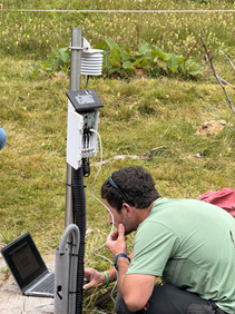
Protocol for the collection of HW critical data.
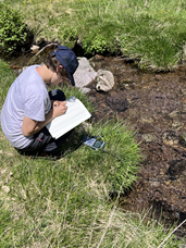
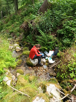
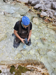
We will deliver a standardized protocol for collecting HW environmental and socio-economic data essential for the vulnerability assessment in WP2, utilizing both existing databases and field surveys. We provide technical expertise to develop and maintain smart, low-cost sensors for continuous hydrological data monitoring. Complementing data such as photographs, videos of water bodies, discharge measurements, and snow cover information will be gathered through public crowdsourcing solutions. -
An open source and user-friendly web-platform for performing HW vulnerability assessments.
We deliver a multi-language web-platform hosting the toolbox for HW vulnerability assessment as co-designed by scientists, target groups, and stakeholders. The platform will facilitate data analysis, updates, sharing problems/solutions among end-users via a dedicated chat, and communication (OI 1.1). User manuals and tutorials will ensure its long-term developments and application to broader contexts within and beyond the AS, aligning with AG7 objectives. -
Tried-and-tested vulnerability assessments at the stakeholder testing sites
The collected data and results from hydrological modelling will allow scientific PPs to produce a first version of HW vulnerability assessment for the stakeholder testing sites. These first assessments will be tested and validated by local stakeholders, enhancing the chances for conclusion support. Such endorsed vulnerability assessments, providing shared and objective insight on water resources issues, are the essential first step to engage territories on the path towards climate adaptation. -
Local multi-stakeholder dynamics towards resilient and adaptive HW management in the testing sites
The results of the HW vulnerability assessment (O2.1) combined with discussion steps between PPs, target groups and stakeholders at the scale of testing sites, will lead to co-designing and testing local-scale best-practices and selecting success factors in tackling water security. This will initiate the path towards the sustainable co-evolution of natural HW ecosystems and human needs, in the view of a Water-Smart Society, at Alpine local to transnational scale. -
Joint solution to incorporate the toolbox in the activities of the municipalities
Solution for the long-term use of the toolbox after the project end based on the regular training of users, including municipal/regional administrations, stakeholders, scientists and practitioners. The use of open-source platforms adheres to the FAIR (Findable, Accessible, Interoperable, Reusable) principle, and, along with the digital innovation provided by the toolbox and its online tutoring, contribute to increase the relevance of digital technologies in AS water management (EUSALP AG5). -
Legal strategies to better consider HW into regional to EU policies
Governance solutions will be proposed at the AS local to transnational level to improve the effectiveness of water and land administrators in securing HW and their future resilience. These solutions will be translated into recommendations addressed first to regional/national policy makers involved as active observers, and, with their support, successively exported to the AS level. These outcomes will ensure a wider incorporation of HW in the policies for water resources management.
Pilots
-
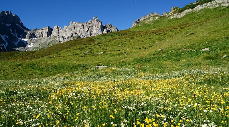
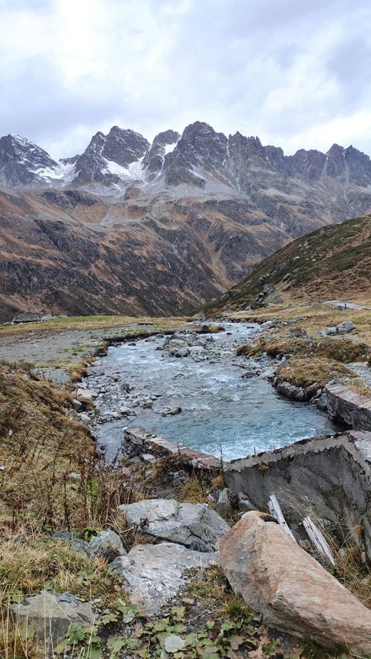
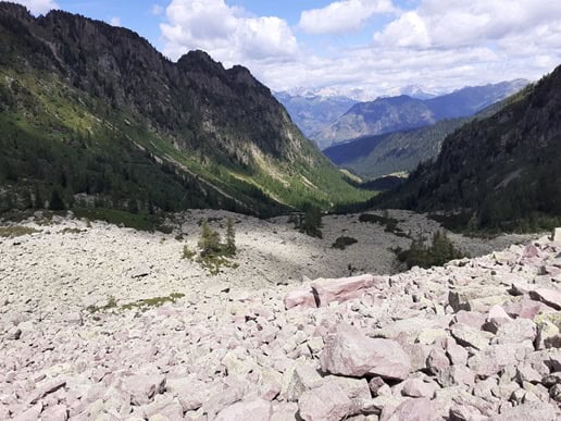
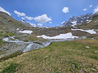
Grande Sassière
Situated on the French-Italian border, the Grande Sassière Nature Reserve occupies a vast Alpine cirque at an altitude of between 1,800 and 3,750 metres. These different levels and exposures give rise to a variety of environments: rocky at higher altitudes, grasslands and meadows further down, and the very rare low marshes left over from the last ice ages. The latter are particularly closely monitored for their rare arctic-alpine flora. The whole of the reserve is located right next to the Vanoise National Park and the Parco Nazionale Gran Paradiso creating a vast binational system of protected areas. Some of the water in this catchment area comes from two glaciers, which feed a dammed lake further down the valley, used as a water reserve for hydroelectric power generation. The glaciers are melting very fast meaning we have to expect drastic changes in the water regimes. A water intake at altitude supplies the municipality and the ski resort of Tignes downstream.
Main challenges
Biodiversity, hydropower, drinking water supply of major ski resort, flooding, changing runoff regime, sediment transport, mass movements (rock fall)
Monitored variables
streamflow data, piezometric data, local climate data, detailled maps of stream/wetland network, detailled geological map, water geochemical data, soil map, vegetation map, cryopshere, stream conductivity temperature, gormophology/connectivity stream network -
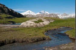
Val d'Ursé (Deployment site) and Valposchiavo
The Val d'Ursé catchment, part of the Valposchiavo Valley, is located in the Bernina range in Canton Grisons, south-east Switzerland. This region, nestled within the high alpine environment, is characterized by temperate Alpine climate. The hydrology of the catchment is shaped by both seasonal precipitation and the dynamics of snowpack melt, which recharge the aquifer systems. The catchment’s stream baseflow is sustained by a highly capacitive groundwater system, primarily hosted within quaternary deposits such as talus moraine and debris, but also through a deeper fractured bedrock aquifer. Snowmelt serves as the principal source of recharge for these aquifers. Permafrost presence and rock glaciers further influence the recharge dynamics, controlling seasonal flow variations. The local hydrology is highly sensitive to climate change, which poses significant challenges to the pristine biodiversity and aquatic ecosystems typical of high alpine settings.
In addition to its environmental importance, the catchment supports pastoral activities, mainly involving sheeps and donkeys. The Ursé stream supplies water to the Poschiavino river, on whose banks the town of poschiavo lies. It further feeds the Adda and the Po river, providing critical transnational socio-economic benefits.
One of the unique specificity of the Alp-Canfinal catchment is the presence of deep boreholes that provide valuable insights into deep groundwater recharge and discharge processes. These boreholes, part of a larger monitoring network established for the Lago Bianco pump storage project, are equipped with pressure and temperature sensors at various depths. For instance, time series data from borehole KB4, measured at depths of 125 and 145 meters, reveal significant hydraulic head variations, with up to 40 meters of head change between baseflow and snowmelt peaks. This information is essential for calibrating hydrological models that will help the team of Waterwise predict the future evolution of the catchment in response to climate change.
The socio-economic research activities will be conducted in Valposchiavo, which will host two stakeholders workshops during the duration of the project.
Main challenges
biodiversity protection, hydropower, water supply, farming/Pastoralism, tourism (hiking)
Monitored variables
streamflow data, piezometric data, spring dynamics, local climate data, detailled maps of stream/wetland network, detailled geological map, water geochemical data, cryopshere, stream conductivity temperature, gormophology/connectivity stream network, geophysics -
Contamines Montjoie
At the southern end of the Mont Blanc Massif, and partly forming the border between France and Italy, the Contamines-Montjoie National Nature Reserve stretches from 1200 to 3892 metres above sea level. With these different levels comes a variety of environments as well as wetlands. The watercourses are fed mainly by melting snow and retreating glaciers and have a glacial regime (maximum flow in summer). The glaciers and wetlands are identified in the objective document as the sectors most threatened by human activity and climate variations, which could ultimately alter the flow of the rivers. The lakes, one of which (Grand lac Jovet) is monitored as part of the national Lac Sentinelles programme, are threatened by tourist numbers, which is why bathing has been banned last summer. At the same time, tourist facilities can affect water quality. A subglacial water intake, which has already been rebuilt following the retreat of the glacier, supplies water via pipes to a reservoir outside the perimeter of the reserve.
Main challenges
biodiversity, hydropower, agriculture, drinking water supply, tourism (alpine huts), ski resort nearby
Monitored variables
streamflow data, piezometric data, local climate data, detailled maps of stream/wetland network, detailled geological map, water geochemical data, soil map, vegetation map, cryopshere, stream conductivity temperature, gormophology/connectivity stream network -
SI-AT transboundary drinking water aquifer at Mt. Peca/Petzen
Transboundary groundwater body Karavanke/Karawanken is the only of such kind between Austria and Slovenia. Mountain peaks are covered by forest, pastures and bare rocks. Well permeable carbonate rocks provide important drinking water resources to both countries, also to inhabitants of the UNESCO Global Geopark Karavanke/Karawanken. The Peca Mt. is the easternmost of five delineated transboundary karstic aquifers with its highest point reaching 2125 m. The Wetterstein limestone at Mt. Peca was mined for lead and zinc at two mines, Peca and Topla, which now supply drinking water and hydropower to neighbouring towns. The mountain is surrounded by River Meža and tribuntaries of River Drava. Average precipitation sums to almost 1500 mm/year. Snowcover is rapidly diminishing and change in recharge is expected to affect also captured carstic springs. Extreme events, such as wind storms and severe floods are becoming abundant and significantly affect the quality of life and ecosystems in the region. Main challenges Drinking water supply in 2 countries, tourism in UNESCO Geopark Karavanke/Karawanken, hydro power plant from dewatering of the Peca Mine, extreme events (extreme floods in august 2023), geohazard mitigation (landslides), biodiversity protection.
Watch an introductive video
Main challenges
drinking water supply in 2 countries, tourism in UNESCO Geopark Karavanke/Karawanken, hydro power plant from dewatering of the Peca Mine, extreme events (extreme floods in august 2023), geohazard mitigation (landslides), biodiversity protection
Monitored variables
streamflow data, piezometric data, local climate data, detailled maps of stream/wetland network, detailled geological map, water geochemical data, soil map, vegetation map, cryopshere, stream conductivity temperature, gormophology/connectivity stream network -
Ischgl Galtuer
The communities of Ischgl and Galtür are located in the upper part of the Paznaun Valley in Austria at the border to Switzerland. The elevation ranges from
1263 to 3384 m a.s.l. covering forests, grassland, permafrost and glaciers. Ongoing measurements comprise recordings within of the Long Term Ecological Research network (LTER), Global Cryosphere Watch (GCW) of the World Meteorological Organization (WMO) and mass balance measurements of the reference glacier Jamtalferner of the World Glacier Monitoring Service WGMS.
Main challenges
changes in runoff magnitude, temporal distribution, sediment load and chemistry by glacier and permafrost melt, biodiversity changes, flood protection, drinking water supply, water power plants, tourism
Monitored variables
streamflow data (1950-, 2017-), piezometric data, local climate data (1948-; 2017-), detailled maps of stream/wetland network (1820-), detailled geological map, water geochemical data, soil map, vegetation map (1870-), cryosphere (mass balance 1988-, length change 1893-, snow water equivalent 1988-), stream conductivity temperature, geormophology/connectivity stream network -
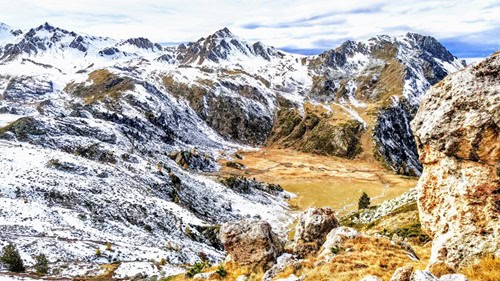
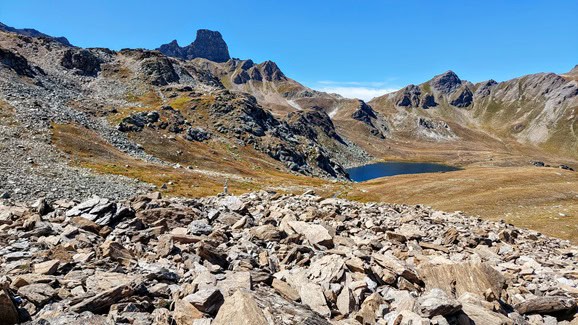
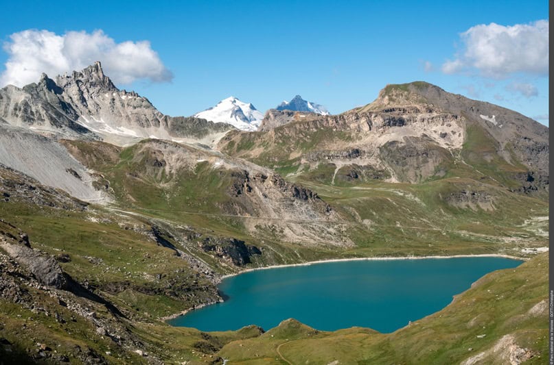
Réchy
The Réchy watershed, covering 11 km², is located in Switzerland within the Vallon de Réchy nature reserve. The catchment area lies above the tree line, with elevations ranging from 2183 m to 3149 m, and a median altitude of 2552 m. Vegetation is sparse, with some areas covered by herbaceous or bushy plants. The rock outcrops consist mainly of low-solubility rocks such as quartzite, gneiss, and calcschist, as well as more soluble evaporitic rocks like gypsum and cargneules.
The site is situated in an intra-alpine valley climatic zone, which is drier than the Swiss average. The watershed follows a snow-dominated hydrological regime, with no glacier contribution. From 2018 to 2023, the mean annual temperature ranged from approximately 0.87°C to 3.8°C, based on data from the Ar du Tsan and Orzival stations. The area also features periglacial landforms, including conditions suitable for permafrost and the presence of the Becs-de-Bosson rock glacier.
Main challenges
water supply, tourism, biodiversity, irrigation
Monitored variables
streamflow data, piezometric data, local climate data, detailled maps of stream/wetland network, detailled geological map, water geochemical data, soil map, vegetation map, cryopshere, stream conductivity temperature, gormophology/connectivity stream network -
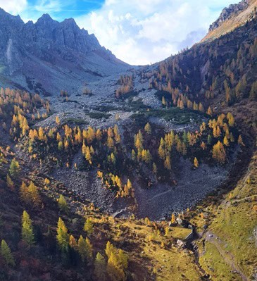
Sadole
The Sadole Valley is a left-hand subcatchemnt of glacial origin of the Fiemme Valley, located in the central Italian Alps (Autonomous Province of Trento, Italy). The Valley extends from the Municipality of Ziano di Fiemme (953 m a.s.l.) up to the Monte Cauriol (2493 m a.s.l.) and its lithology is dominated by outcrops of Permian magmatic rocks (porphyr). The head of the valley is occupied by the Sadole rock-glacier, located along the northern slope of Monte Cauriol (2493 m) at altitudes between 2090 m at its summit and 1820 m at its front. The rock glacier is a complex landform, which has been generated by the confluence of three different rock glaciers and has been classified as ‘relict’ based on its low elevation, and the partial vegetation coverage of the front and body with tall vegetation. However, the low water temperature of the spring emerging from the rock glacier front (Maseron. 1.4-1.8 °C during the whole year) and recent geophysical investigations suggested ice and permafrost conditions as preserved.
The Maseron spring is used for hydoelectric and drinking and purposes, for the latter reason, the spring falls within a hydrogeological protection area. High frequency data for water temperature, discharge, electrical conductivity are being collected from the Maseron spring each hour since 2021. Seasonal monitoring of water chemical and biological quality of Maseron and other two downstream springs started in 2022.
Main challenges
cryosphere reduction; tourism; water quality
Monitored variables
streamflow, temperature, EC data, local climate data, detailed maps of stream/wetland network, detailed geological map, water geochemical data, water ecological quality and biodiversity (diatoms), vegetation map, cryopsPhere, gormophology/connectivity stream network -
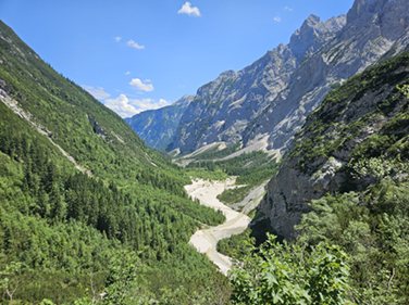
Zugspitze Partnach (DE)
The Zugspitze is part of the Wetterstein mountain range in the Bavarian Alps and has the highest peak of Germany (2,962 masl), located right at the border between Germany and Austria. Two of Germany's very few remaining glaciers lie in close proximity to the peak. As with many other glaciers, the conditions of the so-called Höllentalferner and Schneeferner are rapidly deteriorating due to climate change and corresponding rising temperatures. Consequently, the Zugspitzmassif's appearance will be irreversibly altered. Given a synclinal geological karst situation, the entire catchment is drained by the spring of the River Partnach (1,430 masl, MQ = 1,8 m³/s), allowing for detailed water balances. The area is excellently instrumented and has been systematically monitored for a long time, with some climatical and hydrological measurements going back several centuries. The karst reservoirs at the Zugspitzblatt show significant seasonal variability, often running nearly dry throughout the year and recharging primarily during snowmelt and glacial meltwater leading to buffered hydrographs at the catchment outlet. The River Partnach flows through the Reintal valley and dewaters into the River Loisach after 18 km at the city of Garmisch-Partenkirchen. The catchment area (129 km²) is characterized by a very difference in altitude resulting in diverse climatic conditions and a variety of different vegetation zones. The Partnach Gorge is a highly popular tourist destination where people can explore the white waters and imposing landscape. Thereby, the area is both naturally and economically crucial for Bavaria's Alpine region. Tourism, in particular, faces some major challenges. These problems include the deterioration of the Partnach's water quality caused by contamination from the grazing animals at the pastures. Also ski tourism has to deal with major issues, requiring them to build substantial snow reserves to ensure sufficient snow cover for the next season. This is done to extend the skiing season in order to stay in competition with other ski resorts at higher altitudes in other Alpine countries.
Main challenges
flood protection, tourism, low flow periods, to a minor content hydropower and water supply
Monitored variables
streamflow data, piezometric data, local climate data, detailled maps of stream/wetland network, detailled geological map, water geochemical data, soil map, vegetation map, cryopshere, stream conductivity temperature, gormophology/connectivity stream network -
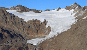
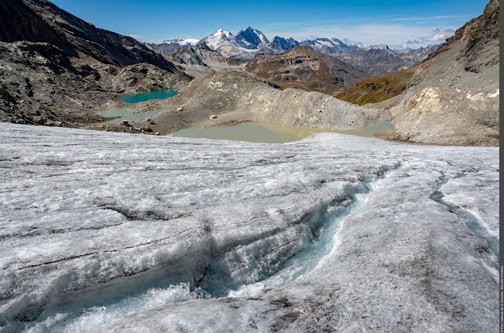
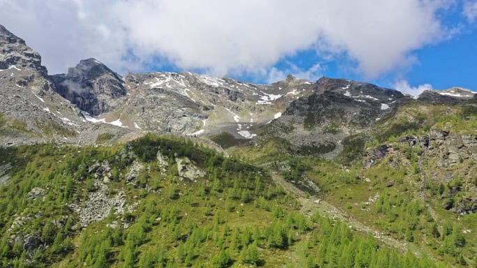
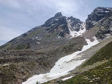
Alpe Sud and Dosegù Glaciers (Deployment sites)
DownloadThe Alpe Sud and Dosegù glaciers are both located within the Stelvio Natural Park and belong to the Ortles - Cevedale group, in Northern Italy. The Alpe Sud glacier has been monitored since 1997 and the Dosegù one from 2016. Since they provide such a long and historical series of data, it is possible to establish trends and foresee climate change actions in this region.
The park has an important role acting as a connecting part between protected areas in Italy and Switzerland. Here flora and fauna are rich and diverse, and humans and the environment coexisted for centuries creating unique habitats.
Videos
Gallery
- Pichioc Waterfallby A.Carron_Halloran Landon James Szasz
- Réchy - Lower catchmentby A.Carron_Halloran Landon James Szasz
- Lake Louché - Réchyby A.Carron_Halloran Landon James Szasz
- Contamines MontjoieRNF 2011
- Grand SassiéreParc national de la Vanoise - BALAIS Christian
- Grand Sassiére - Winter© Parc national de la Vanoise - BALAIS Christian
- Grand Sassiére - Lake© Parc national de la Vanoise - BALAIS Christian
- Ischgl Galtuer
- Petzen MountainUrosh Grabner
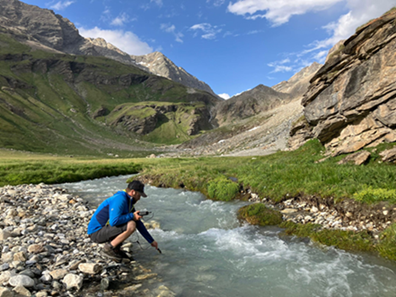
- Val d'Ursé - River
- Val d'Ursé - Mountain
- Sadole Rock Glacier
- Sadole area
- Dosegù GlacierARPA Lombardia
- Réchy, Switzerland
- Partnach River, Germany
- Jamtal Valley, Austria
- Sample Campaign in Sadole Valley, Italy
- Sample Campaign in Slovenia
- Samples Campaign in Germany
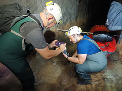
- Samples Campaign in Mt Peca/Petzen Galleries
- Fieldwork Campaign in Grand Sassière, France
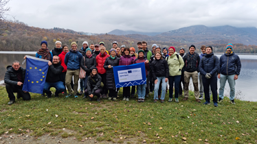
- Family Picture in Avigliana, Italy
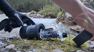
- One of the Smartrocks installed in Waterwise pilot areas
- Fieldwork in Valposchiavo, Switzerland
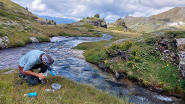
- Sampling Campaign in Les Contamines Montjoie, France
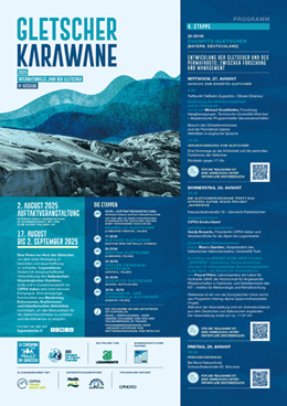
Project calendar