RockTheAlps
Harmonized ROCKfall natural risk and protection forest mapping in the ALPine Space
Home
Outcomes
Overview
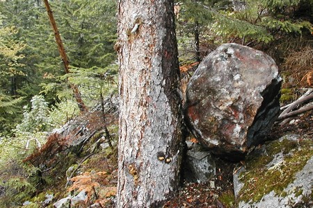
Forests cover 40% of the Alpine area. In addition their many other functions, they are an effective and low cost natural protection from rock falls. RockTheAlps project made the first step towards integrating forests in local protection policies. During the project, researchers gathered data of 10.620 rock falls in the Alps and beyond, calculated a rock fall and a protection model and used them to map protection forests across the 400.000 km of the Alps. Now, this knowledge is accessible foranyone involved in rock fall protection policy-making, thanks to the RockTheAlps toolbox.
Factsheet
- 2014 – 2020
- Liveable
- Enhance the protection, the conservation and the ecological connectivity of Alpine Space ecosystems
-
- Group 6: To preserve and valorise natural resources, including water and cultural resources
- Group 8: To improve risk management and to better manage climate change, including major natural risks prevention
- 11/2016
- 12/2019
- 2.246.417 EUR
- 1.856.844 EUR
Partners
National Research Institute for Agriculture, Food and the Environment (Lead partner)
- Lead partner
- France
- Rhône-Alpes
- Saint Martin d'Heres
- FREDERIC BERGER
- frederic.berger@irstea.fr
French Geological Survey
- France
- Provence-Alpes-Côte d'Azur
- Marseille
Alp'Géorisques
- France
- Rhône-Alpes
- Domène
Slovenian Forest Service
- Slovenia
- Zahodna Slovenia
- Ljubljana
University of Ljubljana, Biotechnical Faculty, Department for Forestry and Renewable Resources
- Slovenia
- Zahodna Slovenia
- Ljubljana
Slovenian Forestry Institute
- Slovenia
- Zahodna Slovenia
- Ljubljana
University of Padova
- Italy
- Veneto
- Legnaro
Department of Agricoltural, Forest and Food Sciences, University of Turin
- Italy
- Piemonte
- Torino
Regional Agency for Services in Agriculture and Forest – Lombardia Region
- Italy
- Lombardia
- Milano
AUTONOMOUS PROVINCE OF TRENTO – FOREST AND WILDLIFE DEPARTMENT
- Italy
- Provincia Autonoma di Trento
- Trento
Politecnico di Torino
- Italy
- Piemonte
- Torino
Federal Research and Training Centre for Forests, Natural Hazards and Landscape
- Austria
- Tirol
- Innsbruck
Austrian Federal Ministery of Agriculture, Forestry, Environment and Water Management
- Austria
- Wien
- Vienna
Bavarian State Institute of Forestry
- Germany
- Oberbayern
- Freising
Bern University of Applied Sciences / HAFL
- Switzerland
- Espace Mittelland
- Zollikofen
- 45.18366835.75448
- 43.23834755.43555
- 45.19908825.8234245
- 46.052666214.480088002780466
- 46.04898975000000414.503956692895823
- 46.052666214.480088002780466
- 45.3469642511.958615392269795
- 44.95779637.5904793
- 45.4892079.1936874
- 46.066422811.1257601
- 45.06297217.6624557
- 47.268863511.3948986
- 48.207945816.3844132
- 48.3994440511.716943743980217
- 46.99154317.468211765711086
Outcomes
-
Access to the rockfall past events database
ToolThis webmap represents the locations of past rockfall events recorded in the Alpine Space. Events are separated into locations of rockfall release areas and rockfall deposits (related to particular rockfall release area).More on the additional attributes of this data is available in the statistics section of the map. Additionally, in the download section of the map, more profiles of past rockfall paths are available in the .CSV database. Larger portion of this profiles is not georeferenced and shown on the map therefore the number of events between this databases differentiates. -
The first Alpine Space harmonized rockfall risk and protection forest webmaps
ToolThe maps are showing the results of an innovative rockfall assessment methodology called ROCK-EU using harmonized criteria and objective data, and past rockfall events recorded in Alpine Space. It represents the first Alpine Space wide harmonized rockfall risk and protection forest webmaps.The download section gives access to the different GIS layers displayed in the webmap. -
ASFORESEE : an AS harmonized methodology for protection FORest Ecosystem Services Economic Evaluation
ToolASFORESEE is the first Alpine Space Harmonized Methodology for Protection FORest Ecosystem Services Economic Evaluation.By using this link, you will download the handbook presenting ASFORESEE model, the model itself and a report presenting the case studies database used for testing the model. -
RockForNet : the free online utility for evaluating the Rockfall Risk Reduction Index of the forested slope
ToolRockforNET firstly estimates the degree of protection of a forest regarding rockfall given the defined conditions. Secondly, it provides the target profile (minimum and ideal) of the forest given those conditions. The degree of protection is the percentage of rocks that is stopped by the forest.