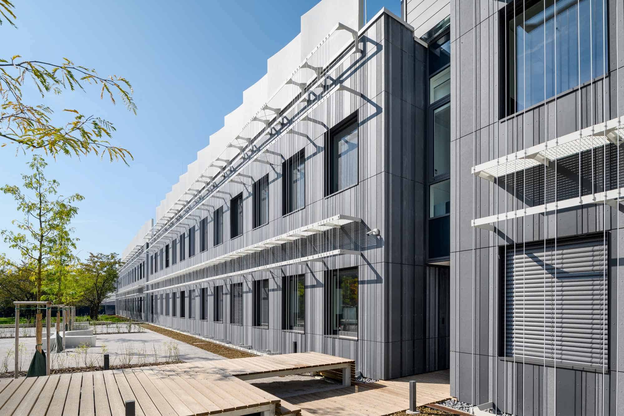
Overview
The rise in water temperatures combined with pollution will alter habitat conditions for many Alpine species. DiMark provides monitoring and early warning system solutions (by linking traditional and satellite observations) to mitigate tourism and eutrophication pressure on Alpine lakes. By creating an innovative monitoring of water quality and early warning systems, the project improves water management, as well as climate mitigation.
Factsheet
- 2021 – 2027
- Climate resilient and green Alpine region
- SO 1.1 - Promoting climate change adaptation and disaster risk prevention, resilience, taking into account eco-system based approaches
-
- AG1 Research & innovation
- AG5 Connectivity & accessibility
- AG6 Natural resources
- AG8 Risk governance
- 09/2024
- 08/2027
- 2.342.224 EUR
- 1.590.933 EUR
Description
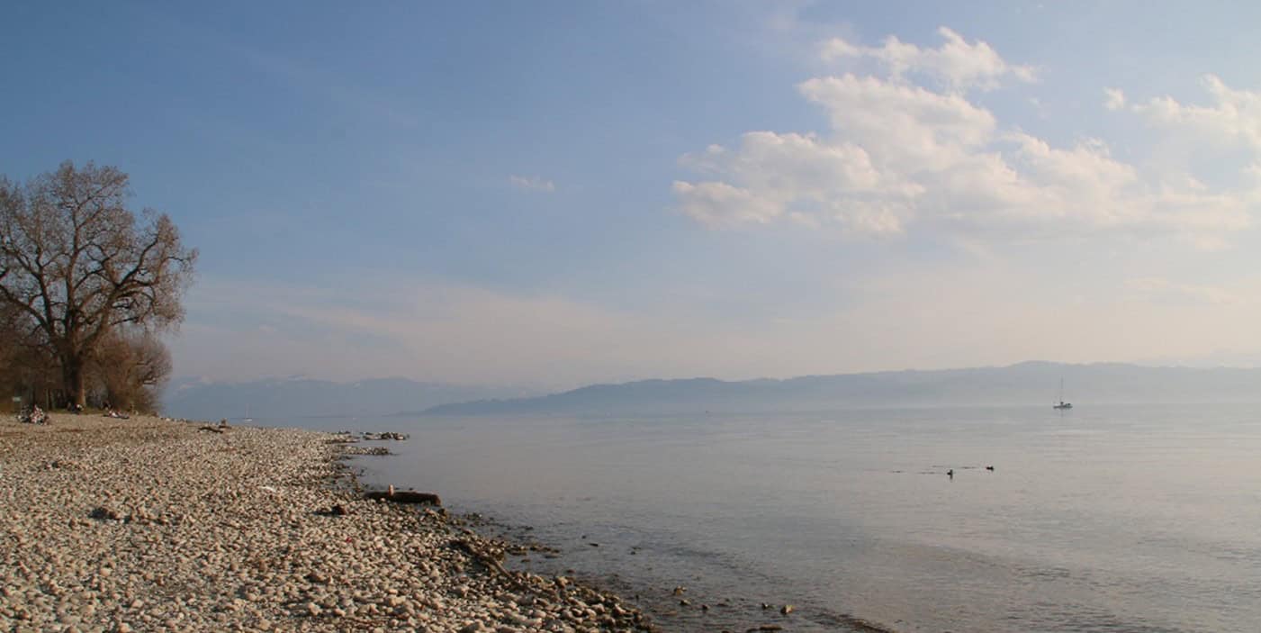
Alpine lakes are facing anthropogenic challenges led by touristic pressures and eutrophication, worsening over time with climate change. Frequent cyanobacterial and algal blooms caused by eutrophication make waters unsuitable for drinking, recreation, and industry. Blooms are accompanied by decreased biodiversity and oxygen depletion, posing a risk to water ecosystem; cyanotoxins in blooms pose also a health risk. The challenges mentioned above can be addressed using novel satellite-based solutions and improved cooperation between academia and decisionmakers.
The project objective is to improve freshwater management, using novel ecosystem-based approaches for climate change adaptation and disaster risk prevention.
The project will develop two innovative ready-to-use solutions:
(1) an online visualisation tool with maps of the Alpine area for inspecting and comparing the water state, based on important freshwater markers, and
(2) a model for cyano-risk prevention, enabling sustainable lake management while minimising health risk.
Solutions will be developed using a multi-stakeholder co-development process, including academia, policy, SME, NGO and citizen stakeholders. The DiMark Transnational Network and Alpine lakes management strategy will enhance the sustainability of project results. The innovative aspect of the DiMark project is linking freshwater markers to satellite data. Establishing these links in a transnational approach is essential because some countries have experts for satellite data analyses, while others have experts for freshwater markers. In addition, water state depends on watersheds stretched across more countries (including border Alpine lakes). The project's main beneficiaries will be national/regional lake managers, decision makers and citizens who will experience better water quality and safety.
Main results/changes are:
(i) improved water quality,
(ii) better response in case of water disaster management and
(iii) improved lake biodiversity.
Partners
- Lead partner
- Slovenia
- Zahodna Slovenija (SI04)
- Ljubljana
- Tina Elersek
- tina.elersek@nib.si
- Slovenia
- Zahodna Slovenija (SI04)
- Ljubljana
- Aleksandra Krivograd Klemenčič
- aleksandra.krivograd-klemencic@gov.si
- Austria
- Tirol (AT33)
- Innsbruck
- Rainer Kurmayer
- rainer.kurmayer@uibk.ac.at
- Austria
- Wien (AT13)
- Wien
- Magdalena Purker
- magdalena.purker@ages.at
- Italy
- Provincia Autonoma di Trento (ITH2)
- San Michele all’Adige (TN)
- Nico Salmaso
- nico.salmaso@fmach.it
- Italy
- Veneto (ITH3)
- Padova
- Giorgio Franzini
- giorgio.franzini@arpa.veneto.it
- Italy
- Campania (ITF3)
- Napoli
- Mariano Bresciani
- bresciani.m@irea.cnr.it
- Germany
- Freiburg (DE13)
- Konstanz
- Dietmar Straile
- dietmar.straile@uni-konstanz.de
- France
- Rhône-Alpes (FRK2)
- Thonon les Bains
- Orlane Anneville
- orlane.anneville@inrae.fr
- Slovenia
- Vzhodna Slovenija (SI03)
- Ptuj
- Darko Ferčej
- darko@ezavod.si
- Switzerland
- Zürich (CH04)
- Zürich
- Daniel Odermatt
- daniel.odermatt@eawag.ch
- 46.050026814.5069289
- 46.050026814.5069289
- 47.263063511.384189121260377
- 48.253337816.4839186
- 46.193405911.1339421
- 45.403362111.8846891
- 40.81925614.1827263
- 47.6592169.1750718
- 46.37313036.4779448
- 46.41779384999999515.874825928236131
- 47.40384388.6095739
Outcomes
-
Alpine meta-data set of freshwater markers
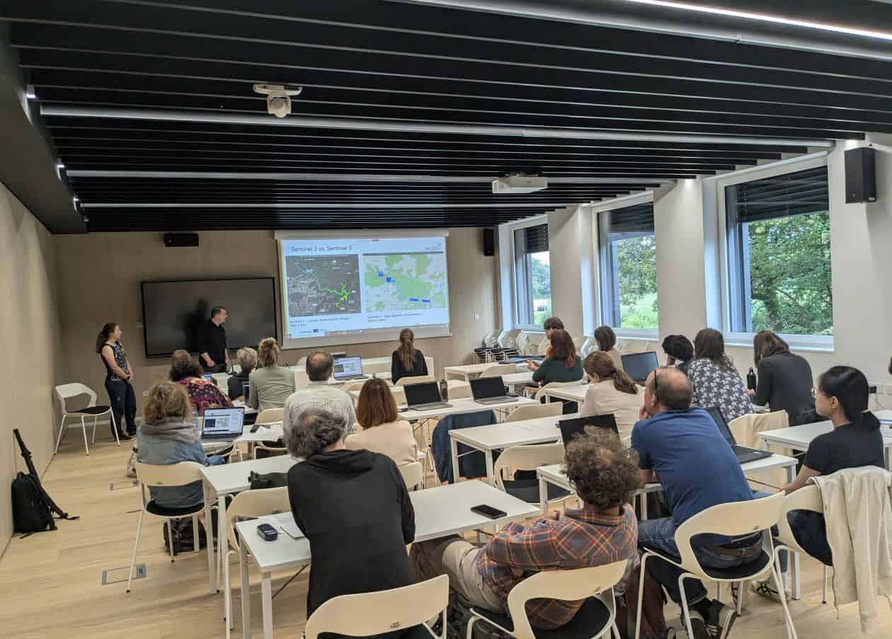
Three data series types (traditional, eDNA, and remote satellite observations) from diverse Alpine lakes will be harmonised in the form of meta-data set. This unique meta-data set of important freshwater markers (e.g. turbidity, pigments) will serve as a much-needed starting point for linking different data sets and enabling correlations inside DiMark Transnational Network for linking digital Earth observation to freshwater markers, and will be available to interested stakeholders. -
Pilot actions
DiMark project will test/validate 2 transnationally developed tools: visualisation tool (O.2.2) as well as risk model (O.2.3) within joint pilot action, which will enable co-development from tools to solutions. The partnership identified 6 key pilot lakes (2 crossborder lakes and 4 other key lakes, presenting the focal point for joint testing and stakeholder activities). In addition, in 50-100 lakes, specific aspects of tools will be tested on a larger scale considering Alpine lakes' diversity. -
Visualisation tool with maps
This solution is an online visualisation tool with maps of the Alpine area for inspecting/comparing the state of waters based on key freshwater markers. This ready-to-use solution will be co-developed; initially set by academia (D.2.2.1) and repeatedly tested by all PP (focusing on policy PP, providing valuable feedback on lake managers perspective), resulting in O2.2. Tool will support also EUSALP AG6 and AG6-led cross-cutting priority. -
Model for cyanorisk-prevention
Model for cyano risk-prevention will enable sustainable management of lakes with minimising health risk. It can be used individually or together with visual. tool (O.2.2.) for a broader understanding of lake state. Also this solution will be co-developed, initially set by academia and repeatedly tested by all PP, focusing on policy PP needs/feedback. It will contribute to EUSALP AG1 (by innovative CC adaptation measures) and AG8 (by natural hazard of cyanotoxins and their risk management). -
DiMark TRANSNATIONAL NETWORK for Linking Digital Earth Observation to Freshwater Markers
This network will be composed of lake managers, decision-makers, practitioners and academia experts to: (i) ensure validated data on Alpine lakes water quality, (ii) advise policymakers with appropriate mitigation/prevention actions addressing acute problems; e.g. eutrophication, water availability, cyanoblooms, & (iii) improve transnational science-policy communication. Runs in parallel with pilot actions (O.2.1) where all involved can voice concerns/expectations about solutions (O.2.2 & 2.3). -
Transnational strategy on using satellite-based tools for freshwater management
In the frame of DiMark Network (O.3.1), the strategy will be prepared for achieving common Alpine strategic guidance on tackling lake-related issues by using developed solutions and proposing prevention/mitigation measures (linked to EUASALP AG1, 5, 6 & 8). The strategy will also consider information exchange and a common approach to the (inter)national/regional governments and decision-makers. Letters of commitment (at least 6) will be signed by relevant parties to ensure long-term cooperation.
Pilots
-
Lake Bled (SI)
Although Lake Bled is a very small Alpine lake (1,5 km2) it is a national icon and the most important Slovenian lake for tourism. Celebrated for its stunning island, Lake Bled has seen rising environmental pressures from tourism and shoreline development.
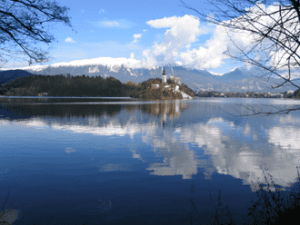
Lake Bled. (Photo: Anja Bubik)
Activities like tourism, old infrastructure and fish feeding, add to nutrient pollution, fueling potentially harmful cyanobacterial bloom. These blooms can disrupt the lake’s delicate ecosystem, turning the seemingly pristine lake water putrid brown or red. Lake Bled is the only lake in Slovenia which occasionally turns into scarlet color, all other Slovenian lakes and accumulations with cyanobacterial bloom are more greenish in color (www.ciano.si).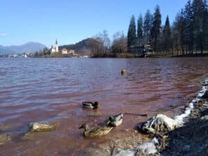
A dense scarlet bloom of the potentially toxic cyanobacteria Planktothrix rubescens on the lake surface. (Photo: Tina Eleršek)
To tackle these challenges, the DiMark project will study different Alpine lakes and create advanced visualization tool and model for early warning system. While being the smallest key lake in DiMark, Lake Bled is on the limit for satellite observation, but anyway, by integrating traditional techniques with satellite observations, DiMark will try to predict and mitigate the impacts of eutrophication on Lake Bled and to protect its ecological well-being for future generations. -
Lake Mondsee (AT)
Mondsee is a mid-sized Alpine lake in Austria (around 14 km²), located in the Salzkammergut Lakes area, known for its warm summer temperatures and popularity among locals and tourists. It’s surrounded by villages and settlements and agriculturally used landscape. This lake allows plenty of recreational activities like swimming, diving, sailing, and paddleboarding (SUP) as well as camping or fishing. Its shoreline is home to cultural events and festivals throughout the year, making it one of the more active lakes in the Salzkammergut region. The lake supports a variety of aquatic species, including two native fish species leading to its Natura 2000 status. The lake ecosystem provides habitat for red-list waterbirds, amphibians and mammals. Its wetlands and littoral zones are ecologically most valuable, though increasingly pressured by human activity. The relatively large catchment of 250 km² results in a higher sensitivity of the lake ecosystem to global change, including eutrophication through run-off events but also by tourism and in general land use. These nutrients can feed algal and cyanobacterial blooms, especially after extreme precipitation events and stratified conditions in the water column. Such blooms may reduce water quality, endanger aquatic life, and can disrupt recreational use - posing risks both to the environment and public health
This is why DiMark offers an excellent opportunity for this particular lake to co-develop, together with local stakeholders and other experts, both a visualisation tool and a cyano-risk prevention model, enabling better and more efficient water management. -
Lake Garda (IT)
Lake Garda, the largest lake in Italy (covering over 370 km²), is one of the most iconic and visited lakes in the Alpine region. With its mild climate and easy access from cities like Milan and Verona, Garda attracts millions of visitors every year for swimming, sailing, windsurfing, and sightseeing.
Despite its beauty, Lake Garda faces increasing pressure from tourism, especially during peak summer months, leading to overloaded wastewater systems and increasing pressure on the lake’s natural habitats, high recreational use - from boats and marinas to lakeside resorts - contributes to nutrient inflows, which over time can lead to eutrophication and the appearance of harmful algal blooms.
As part of the DiMark project, Lake Garda will serve as an important pilot for testing scalable monitoring systems and the model for cyano-risk.
The goal is to give local authorities and lake managers a clearer picture of when and where water quality issues may arise - helping them respond more effectively and plan long-term measures to protect the lake's ecosystem. For a lake that provides drinking water, supports agriculture, fisheries, and tourism, such a tool is essential for improved water management and protecting environmental health. -
Upper Lake Constance (D/CH)
Upper Lake Constance - known as Bodensee - Obersee - is one of the largest lakes in Central Europe, lying between Germany, Austria, and Switzerland. Covering more than 470 km² and reaching depths of over 250 m, it plays an important role in drinking water supply, fisheries, recreation, and cross-border cooperation. With alpine rivers like the Rhine flowing into it, and an extensive catchment that includes agricultural, industrial, and urban areas, Lake Constance is an important and complex freshwater system.
Although Lake Constance has benefited from decades of international cooperation on water protection, new problems are emerging. Warmer summers and changing rainfall patterns can promote algal and cyanobacterial blooms, especially in shallow bays and areas near river inflows. These blooms may reduce water quality, threaten biodiversity, and pose a risk to bathing areas. Likewise invasive species such as the Quagga mussel disrupt the food web and energy flows of the lake. The large size of the lake and the fact that it is shared by three countries make coordinated monitoring and rapid response particularly important.
As a key pilot site within the DiMark project, Upper Lake Constance offers a unique opportunity to test cross-border approaches to early-warning systems and data visualisation tools. DiMark will link traditional water quality monitoring with satellite-based Earth observation, helping authorities detect and track bloom risks in near real time. This is especially valuable in border zones, where lake conditions can change quickly and responsibilities are shared. -
Lake Geneva (CH/FR)
Lake Geneva - or Lac Léman, as it’s known in French - is one of Europe’s largest lakes, stretching across Switzerland and France with a surface area of over 580 km². Surrounded by vineyards, the nearby Alps, and cities like Geneva, Lausanne, and Évian, the lake is both a natural wonder and an active, multi-use lake supporting transport, tourism, and water supply. It provides drinking water, supports fisheries, fuels hydropower, and draws millions of people to its shores each year for swimming, sailing, and tourism.
In the past, Lake Geneva suffered from severe eutrophication, especially during the 1970s and 1980s. Intensive agriculture, industrial waste, and untreated sewage led to nutrient overload, algal blooms, and oxygen depletion in deep water. A long-term international effort involving both countries helped reduce phosphorus levels and improve wastewater treatment, setting a good example for cross-border water protection.
Today, the picture is changing again. Rising surface temperatures and longer stratification periods can make the lake more vulnerable to algal and cyanobacterial blooms, even at relatively low nutrient levels. Warmer summers and intense rainstorms increase the risk of runoff and re-suspension of nutrients from sediments - especially near the Rhône inflow and urban shorelines.
For DiMark, Lake Geneva offers a chance to apply modern tools to an old but evolving challenge. The lake is large, deep, and internationally governed - making it an ideal testing ground for the satellite-based visualisation platform and the cyano-risk model. These tools will help lake managers, public health authorities, and municipalities respond more quickly to signs of bloom development and shifts in water quality. -
Greifensee (CH)
Greifensee is a small but ecologically significant lake located just northeast of Zurich, Switzerland, covering about 8.5 km². Despite its modest size, it plays an important role in the region: serving as a drinking water source, recreation area, and biodiversity hotspot. Its proximity to urban centers makes it a popoular destination for walking, birdwatching, kayaking and swimming.
Greifensee is experiencing elevated nutrient levels from agriculture and wastewater, which cause oxygen depletion and cyanobacterial blooms. Thanks to improvements such as improved sewage treatment and stricter agricultural practices, phosphorus inputs have decreased, but they remain noticeable and nutrient recycling from sediments prevents the lake’s recovery from eutrophication, too. Its manageable size makes detailed monitoring possible, but internal nutrient cycling, variable bloom conditions, and diverse human uses continue to present challenges. Warmer water temperatures and stronger thermal stratification can extend the bloom season and reduce oxygenation in deeper layers, which may occasionally release phosphorus stored in sediments, supporting new blooms even if external nutrient inputs have been reduced.
Within the DiMark project, Greifensee is a key pilot site for understanding how small, shallow lakes at lower elevations - especially those at the interface of agglomerations and rural areas - may respond to warming and changing nutrient dynamics. This will help local authorities anticipate harmful conditions and deal with water management more efficiently.
Project calendar