Overview
Alpine communities’ quality of life is currently facing several challenges such as the depopulation of remote areas, reduced provision of services of general interest, the impacts of climate change, and mistrust of governance. These issues are not only reshaping the Alpine territories but also impacting the daily lives of its inhabitants. Despite the urgent need for responsive and inclusive governance, there is currently a significant gap in understanding and addressing quality of life at the local level which our project aims to address.
Focusing on the local governance, GOVQoL offers a transformative approach by empowering Alpine communities with the necessary tools, knowledge, and skills to integrate quality of life into their policy-making processes. The project recognizes that local governance plays a crucial role in improving the daily lives of residents and ensuring that quality of life is embedded in long-term strategies. Through GOVQoL, we aim to build the capacity of local administrations, engage diverse stakeholders, and create place-based solutions that are not only responsive to local needs but also aligned with broader Alpine policies.
By increasing local governments’ and stakeholders’ knowledge with exchanges of best practices, and by supporting them in developing local roadmaps for action, GOVQoL aims to contribute to a more inclusive, sustainable, and resilient Alpine region. With its focus on local governance and community-led participation, this project will empower policy-making in the Alpine communities and make it more place-based and considerate of quality of life.
Factsheet
- 2021 – 2027
- Cooperatively managed and developed Alpine region
- SO 4.1 - Enhancing institutional capacity of public authorities and stakeholders to implement macro-regional strategies and sea-basin strategies, as well as other territorial strategies
-
- AG2 Economic development
- AG3 Labour market, education and training
- AG6 Natural resources
- 01/2025
- 12/2026
- 442.500 EUR
- 331.875 EUR
Description
Objectives:
- Analyse the current state of the local governance concerning quality of life
- Improve the skills of the local administration
- Empower the governance capacity of Alpine communities by embedding quality of life in long-term policy-making
- Increase stakeholders’ knowledge and awareness to be more sensitive and proactive in considering quality of life as a relevant policy issue
Key activities:
- On-site workshops with local communities to evaluate the current state of quality of life governance in selected Alpine communities, identify gaps, and build tailored solutions;
- Awareness raising seminars to increase understanding of quality of life governance and highlight the impact for Alpine communities;
- Place-based roadmaps for the development of actionable local strategies to integrate quality of life in policy-making processes on a long-term basis;
- Alpine umbrella roadmap gathering best practices and governance instruments in a handbook, available in all Alpine languages.
Project partners:
Lead partner: University of Ljubljana – Slovenia
www.uni-lj.si/
Naja Marot, naja.marot@bf.uni-lj.si
Community Network Alliance in the Alps – Germany
alpenallianz.org
Katharina Gasteiger, info@alpenallianz.org
Politecnico di Torino – Italy
www.polito.it/
Erblin Berisha, erblin.berisha@polito.it
French committee of the International Commission for the Protection of the Alps – France
www.cipra.org/fr/cipra/france
Julika Jarosch, julika.jarosch@cipra.org
Partners
- Lead partner
- Slovenia
- Zahodna Slovenija (SI04)
- Ljubljana
- Naja Marot
- naja.marot@bf.uni-lj.si
- Germany
- Oberbayern (DE21)
- Übersee
- Katharina Gasteiger
- info@alpenallianz.org
- Italy
- Piemonte (ITC1)
- City Torino
- Erblin Berisha
- erblin.berisha@polito.it
- France
- Rhône-Alpes (FRK2)
- Grenoble
- Julika Jarosch
- julika.jarosch@cipra.org
Outcomes
-
Identification of governance gaps and local needs for preparation of place-based policies concerning QoL within the Alpine area
Multiple organisations co-operate to identify governance gaps and the needs of Alpine communities in regard to QoL and societal well-being. The co-operation first materialises within 5 Alpine countries (AT, DE, FR, IT, SI) due to language limitations. Afterwards, the outcomes of WP1 are jointly evaluated and summarised in an on-site workshop to elaborate on Alpine specifics of QoL governance and its gaps. PPs, Alpine convention(observer) and some of the local communities participate in this. -
Roadmaps to strengthen and improve local governance in regard to QoL
Each of 10 local communities use collaborative approaches to prepare 2 roadmaps: 1st aims at strengthening local governance: integration of QoL into existing policies and policymaking processes on various gov. levels. Second one aids local civil society to monitor how local adm. is performing in regard to their societal well-being. -
The Alpine roadmap on better local governance for the quality of life
Finally, the Alpine roadmap is prepared jointly by PPs to guide Alpine organisations, active in governance, pursuing QoL as policy topic on supranational level. Alpine roadmap represents a synthesis of the work done on the local level and includes guidelines on how Alpine communities can intensify sensitivity to QoL in the governance, and which instruments/tools appeal to the Alpine context most and could be transferred. -
Roadmap development process as pilot action in the local communities
Pilot action consists of the roadmap development process in 10 local communities. PA entails inclusion of the representatives of the communities into knowledge capacity building seminars to teach them about available governance tools, engagements of various local stakeholders in the workshops and other activities, all with the purpose to prepare two roadmaps for each of the communities. Pilot action results in a technical report on the process of co-development and validation of roadmaps.
Pilots
-
Jesenice (Upper Carniola), Slovenia
Jesenice is a Slovenian municipality with about 22.000 inhabitants and a surface area of 76 km² located in the northern Gorenjska region bordering Austria, and precisely situated in the Sava valley. This valley serves as a connection between Central and Southeastern Europe as it is located along a major transport corridor. Jesenice was historically an industrial town highly dependent on the steel industry. Tourism is not a key industry in Jesenice as there are predominantly day tourists, however there is potential due to the municipality's proximity to the Triglav national park, and the touristic hotspot Bled, the surrounding mountains as well as cultural and sport events that take place.
ECONOMIC, SOCIAL AND TERRITORIAL CHARACTERISTICS
- Besides heavy industry the economy has diversified to services, trade, construction, and small manufacturing enterprises.
- Working-class community, formed through internal migration from other parts of former Yugoslavia, attracted by industrial employment.
- Great logistic relevance due to its location in the Sava river valley functioning as a connection between Central and Southeastern Europe
- The Karavanke Mountains form a natural barrier to the north, while the Mežakla Plateau rises to the south
- Healthcare is provided through the general hospital offering specialized care, pharmacies as well as elderly care
- Childcare and education including kindergartens, primary schools and secondary schools is available
- Access to Culture centers and a public library
- Offers for indoor and outdoor sports activities
- Infrastructure in the form of public transport and well-developed road connections to Ljubljana and Austria
- Jesenice serves as a regional center in the Upper Gorenjska region
- Job losses through the decline of heavy industry and limited job opportunities for younger residents
- Integration of diverse ethnic groups due to the town's history of migration for industrial employment
- Majority of the housing stock requires modernization to meet modern energy efficiency and comfort standards
- Through the history of heavy metal industry, the municipality still struggles with industrial pollution requiring continuous investment in environmental improvements
- The linear urban form along the Sava valley limits spatial expansion to the sides and contributes to traffic congestion which affects the residents' quality of life
-
Črna na Koroškem (Carinthia), Slovenia
Črna na Koroškem is a small and rural municipality with about 3.000 inhabitants and a surface area of 156 km², located in the west of the Koroška region, bordering Austria. It is situated in the narrow Upper Meža Valley under the Peca range which gives it an Alpine character, in a remote area where the population density is at 20 inhabitants/km² which is significantly lower than average (105 inhabitants/km²) and among the least densely populated municipalities in Slovenia. . Institutions such as secondary schools or specialized healthcare is not available, and residents are required to go to Ravne na Koroškem, Slovenj Gradec or Celje. Concerning the mobility infrastructure the closest motorway exit is nearly 50 km away; there is no railway and bus connections are scarce.
ECONOMIC, SOCIAL AND TERRITORIAL CHARACTERISTICS- Historically the region was mostly dependent on mining which shaped the spatial development of settlements as well as the landscape
- Surrounding landscape and mountains attract visitors in summer and wintertime, so tourism is increasing
- The remote location leads to limited access to certain services or employment opportunities, which leads to an outwards migration and ageing of the population
- The municipality has a comparatively large surface area of 156 km² in mountainous terrain, which is predominantly covered by forest
- Basic healthcare is provided by a medical center and a pharmacy, whereas specialized care can be found in Ravne na Koroškem or Slovenj Gradec
- At the moment, elderly care is still under construction
- For education and childcare there are kindergartens as well a a primary school in Črna
- Access to secondary school only is available in nearby towns
- Recreational infrastructure is provided mostly outdoors (e.g., zip-lining, cycling, and hiking)
- The infrastructure needs improvement as public transport is poor, and some remote hamlets lack internet connection
- Limited employment opportunities require younger residents to move to urban areas
- Population ageing (average age is 47 years, compared to the national average age of 44 years)
- As the older population increases, demanding for healthcare and social support is growing
- Both population ageing and outward migration reduce the local labour force, limit the community’s vitality and can lead to isolation amongst residents
- Accessibility and connectivity issues are being faced, both in terms of transport and digital infrastructure being demanding in sparsely populated mountain terrain
- The availability of services is limited, some of the existing services operate only limited hours (e.g., library)
-
Nationalpark region Kalkalpen (Upper Austria), Austria
The National Park Region lovated in Upper Austria, unites 22 municipalities, covering 1,618 km²—the largest LEADER region in the state.
Over 44,000 residents live across the Ennstal, Steyrtal, and Pyhrn-Priel areas. At its heart lies the Kalkalpen National Park, spanning 20,850 hectares of protected nature.
Mission statement: “The quality of life of the people in our region is at the heart of our work!”
ECONOMIC, SOCIAL AND TERRITORIAL CHARACTERISTICS
The region is characterized by small-scale agriculture, forestry, and a growing tourism sector focused on nature, outdoor recreation, and sustainable development.
While traditional industries such as wood processing and craftsmanship remain important, many residents commute to larger nearby towns like Steyr and Kirchdorf an der Krems for employment.
CHALLENGES OF QUALITY OF LIFE
Demographic change and out-migration of younger people present ongoing challenges, but the area benefits from strong local identity, active community initiatives, and increasing investment in eco-tourism, renewable energy, and regional value chains.
The overall quality of life is high, supported by intact natural landscapes and a commitment to sustainable rural development. -
Nenzing (Vorarlberg), Austria
Nenzing is a market town in the district of Bludenz, in the Austrian state of Vorarlberg.
Located at 533 m above sea level, it covers an area of 110.31 km², making it the fourth-largest municipality in Vorarlberg.
About 49.3% of its area is forested and 21.1% is alpine. The highest peak is Panüler at 2,859 m. As of January 2025 the population is 6,528.
ECONOMIC, SOCIAL AND TERRITORIAL CHARACTERISTICS
Nenzing is characterized by a balanced mix of industry, services, and agriculture.
Many residents work in nearby industrial centers such as Bludenz and Feldkirch, while local small and medium-sized enterprises support employment within the municipality.
The economy benefits from its location along major transport routes and proximity to the Rhine Valley.MAIN FUNCTIONS/SERVICES
Nenzing’s spatial development concept (REK) promotes balanced growth between housing, employment, and nature to maintain a high quality of life.
The municipality has a good cooperation within the Regio Walgau.
Liebherr and other companies provide jobs and business tax revenue – they seek a high quality of life for their employees.
The municipality’s “Wohnraum mobilisieren” initiative activates vacant housing and supports affordable living for local residents.
Through regional cooperation such as “Sozialraum ist Lebensraum,” Nenzing focuses on inclusive community development and strong social infrastructure.CHALLENGES OF QUALITY OF LIFE
While living standards are high, with well-developed infrastructure and modern educational facilities, Nenzing has no overarching strategy and no monitoring. The new mayor puts his focus on maintaining social meeting points, youth involvement and volunteer work.
Tourism, forestry, and alpine agriculture contribute to the local economy, complemented by a stable housing market and active cultural life.
-
Grassau (Bavaria), Germany
Grassau is a market town in the district of Traunstein, in the German state of Bavaria. Located at 538 m above sea level, it covers an area of 35.66 km², lying in the foothills of the Chiemgau Alps near Lake Chiemsee. About 45% of its area is used for agriculture and 35% is forested. The highest point in the municipality is the Hochplatte at 1,587 m. As of January 2025, the population is 6.910.
ECONOMIC, SOCIAL AND TERRITORIAL CHARACTERISTICS
Grassau has a well-balanced and stable local economy. It acts as a small center for the Achental, with shops and medical services.
The town benefits from its proximity to Lake Chiemsee and the Chiemgau Alps, making tourism a key economic sector alongside small-scale manufacturing, crafts, and services. Agriculture and forestry also play an important role in maintaining the region’s rural character.
MAJOR FUNCTIONS/SERVICES
The LEADER strategy for the Chiemgauer Seenplatte region, including Grassau, aims to enhance quality of life by strengthening community cohesion, sustainable mobility, and access to local services. It promotes vibrant village centers, cultural identity, and climate-friendly living environments.
Beside the LEADER-region, Grassau ist cooperating with the municipalities of the Ökomodell Achental, in fields of sustainable development, renewable energy, mountain farming and nature protection.
Grassau focuses on balancing economic activity with environmental protection to maintain a high standard of living in a close-knit, nature-oriented community. The municipality does not have one strategy document, but concepts for various fields, such as a retail concept or a new land use plan.
CHALLENGES OF QUALITY OF LIFE
Many residents commute to nearby urban centers such as Traunstein and Rosenheim for work, supported by good regional transport connections.
Grassau enjoys a high standard of social life, with strong community structures, active clubs, a cultural center, sports infrastructure, a youth center, year-round events, etc. -
Ala (Trentino), Italy
Ala is a municipality, granted city status by imperial decree in 1765, located in the valley of the Adige River in the southern part of the Autonomous Province of Trento. Historically and geographically a borderland between the Austro-Hungarian Empire and the Kingdom of Italy, as well as between the pre-Alpine region and the Po Valley. The territory includes vast green areas by extensive forests, pastures, and alpine farms, mostly under public ownership.
ECONOMIC, SOCIAL AND TERRITORIAL CHARACTERISTICS
The city has a diversified economic base:- Agriculture, particularly viticulture, remains central, with one of the largest vineyard areas in Trentino.
- Forestry and alpine pastures further contribute to its rural landscape
The population has remained stable in recent years, and local social life is dynamic:- Low unemployment and a strong employment rate
- More than 50 active associations for supporting social life.
Civic participation also faces constraints, with young people less involved in community life, while the growing demand for elderly care requires renewed welfare solutions.
Ala acts as a junction between different cultural and economic areas:- A borderland between Austria and Italy; the Alps and the Po Alley
- Located in the Adige Valley along the Brenner corridor
MAJOR FUNCTIONS/SERVICES- Education and culture: nursery school, public library, Provincial Museum of Textile Arts and Textiles
- Sports and leisure: swimming pool, gyms, and a tennis center.
- Mobility and health: railway station, hospital unit, and day center for the elderly.
- Public administration: well-structured system of municipal services.
- Tourism and culture: difficulty in positioning the municipality in relation to nearby attractions (Rovereto, Monte Baldo, Lake Garda).
- Urban vitality: commercial desertification of the historic centre.
- Housing: limited supply of adequate and affordable housing.
- Heritage: preservation of architectural, historical, and traditional assets in both the town centre and rural/mountain areas (malghe).
- Demographics: growing need for services for non-self-sufficient elderly people.
- Youth: Difficulties in the engagement of younger generations in civic and cultural life.
- Economic transition: balancing rural traditions with industry, crafts, and services.
- Social spaces: need for renewed places of daily interaction for young and elderly citizens.
- Participation: necessity to foster innovative and participatory models of civic involvement, including the renewal of third-sector organisations.
-
Lanzo Torinese (Piedmont), Italy
Lanzo Torinese constitutes the gateway of the three homonymous Alpine Valleys, that are located at the heart of the Graian Alps. Located in Piedmont, on the border between Italy and France, this area is home to the highest mountains in the region and historically the birthplace of Italian mountaineering.
ECONOMIC, SOCIAL AND TERRITORIAL CHARACTERISTICS
Lanzo Torinese is a rural municipality with a population of slightly over 5,000 inhabitants.
Despite its rural characteristics, it constitutes the main centre of the area, and the gateway of a comb-shaped system of dead-end Alpine valleys.
Agriculture- The fastest growing sector of Lanzo’s economy.
- Many young entrepreneurs under the age of 39 are involved in this sector, and there is a lot of food production by local craftsmen.
- The number of craftsmen once at the heart of the local economy and business development, is decreasing.
Lanzo Torinese is located in the Metropolitan Area of Torino, 34 km away from Torino and 11 km from Cirie Municipality.
The area comprises the three valleys, and the end of each valley is reachable only by one way; therefore move around the valley, it is necessary to go forward and backward to Lanzo Torinese.
MAJOR FUNCTIONS/SERVICES- Education and culture: nursery school, public library
- Sports and leisure: swimming pool, gyms, and a tennis center.
- Mobility and health: railway station, hospital, and day center for the elderly.
- Commercial activities: grocery, local farmers’ market, specialised shops, pharmacy
- Public administration: well-structured system of municipal services.
- Decreasing population and lack of community engagement
- Economic and commercial difficulties for local shops and farmers
- Ageing population and social fragmentation isolates elder people from the city life
-
Veynes (Hautes-Alpes), France
Municipality of Veynes
Introduction
Veynes is a French municipality with around 3,300 inhabitants and a surface area of approximately 43 km², located in the Hautes-Alpes department in the South region. Situated in the Petit Buëch valley, at the transition between the Southern Alps and the Provençal lowlands, Veynes was historically shaped by railway and administrative functions, which played a central role in its economic and demographic development.
ECONOMIC, SOCIAL AND TERRITORIAL CHARACTERISTICS
Veynes has a small-scale, diversified local economy, typical of medium-sized rural service towns in the Southern Alps. Historically Veynes was positioned as an important logistical and administrative center. While the importance of the railway sector has declined, it remains a symbolic and functional asset.
- The local economy is primarily based on public and private services (administration, education, healthcare, retail), small businesses and crafts,(including construction, maintenance, and local trade), agriculture, mainly livestock farming and small-scale agricultural activities in the surrounding areas
- A moderate population size with a stable but slightly aging demographic profile with a mix of long-term residents and newer inhabitants seeking a rural quality of life
- Strong local identity and community cohesion, supported by cultural, sporting, and associative life
- The territory is marked by a balance between human activity and environmental constraints, requiring careful land-use planning, risk management (flooding, landslides), and environmental protection. The surrounding natural environment represents both a constraint and an opportunity, particularly for sustainable development and nature-based tourism.
- Veynes hosts municipal and cantonal administrative functions and provides public services for the surrounding rural communes
- The town plays an important role as a railway junction and road connection point, ensuring regional accessibility and daily mobility.
- It concentrates shops, small businesses, crafts, and local markets that meet everyday needs for residents and nearby villages.
- Veynes offers primary and secondary education, basic healthcare, and social support services, contributing to territorial cohesion.
- The municipality hosts sports facilities, cultural venues, and local events that strengthen social life and quality of living in the area.
- Need to work on attachment attitudes (e.g. attachment to being able to park in the city center when there are parking spaces a 5-minute walk away)
- There is a lack of training in collective intelligence tools. This should be the responsibility of schools.
- What is most lacking in small communities is engineering especially regarding risk management (storms, torrential rain, fires).
- The challenge of maintaining the community fabric, with significant financial restrictions.
- The challenge of developing more cultural and social activities as f.ex. there are no longer any educators or youth workers in neighbourhoods in particular.
- Maintaining social life and democracy.
-
Parc nature régional des Baronnies provençales (Drôme / Hautes-Alpes)
Regional nature park Baronnies Provencales
Introduction
The Regional Natural Park Baronnies provençales is a protected rural territory in southeastern France, covering approximately 1,560 km² and encompassing around 130 municipalities with a population of about 36,000 inhabitants. It is located between the Drôme and Hautes-Alpes départements, at the transition between the Northern Alps and Provence, and is characterized by a mountainous, mid-altitude landscape structured by valleys and ridge-lines. The area is relatively remote and not situated along major transport corridors, contributing to its low population density and strong rural character. Historically, the territory has been shaped by agriculture, particularly livestock farming, olive cultivation, and aromatic plants, as well as small-scale rural activities.
ECONOMIC, SOCIAL AND TERRITORIAL CHARACTERISTICS
- The territory is characterized by small-scale economic activities, mainly agriculture (livestock, olives, aromatic and medicinal plants), crafts, and local services, with limited industrial presence.
- Tourism is largely oriented toward outdoor activities and natural heritage, generating complementary income but remaining seasonal and insufficient to structure the economy on its own.
- The population is relatively small, aging, and unevenly distributed across numerous villages, creating challenges in maintaining services, employment, and social cohesion.
- The territory combines Alpine and Mediterranean landscapes with high biodiversity, protected areas, and a dark-sky reserve, shaping land use and development constraints.
- The area is not located along major transport corridors and is organized around valleys and small settlements, reinforcing its rural character while limiting accessibility and economic integration.
The Park's mission is to take up the challenge of "Living well together in the Baronnies Provençales" which means concretely :- to protect this heritage, in particular through appropriate management of natural environments and landscapes,
- to contribute to regional planning,
- to contribute to economic, social and cultural development and quality of life,
- to welcome, educate and inform the public,
- to carry out experimental or exemplary actions in the above-mentioned areas and to contribute to research programmes.
- Resilience of the territory and its population by adapting to climatic, societal and economic changes...
- Designing a coherent, cohesive and sustainable development plan for the Baronnies Provençales region (urban planning, energy territory, cultural offer, .…)
- Relocalising the economy based on local identity and the promotion of local resources (agriculture, sustainable tourism & nature activities, anticipate and innovate by valorising new local resources, ...)
-
Weyer (Upper Austria), Austria
Weyer (Upper Austria), Austria
Weyer is an Austrian market municipality with about 4,000 inhabitants and a surface area of 223 km², located in the district of Steyr-Land in Upper Austria. The municipality lies in the Enns Valley near the borders with Styria and Lower Austria and is surrounded by mountainous landscapes of the Ennstal and the Kalkalpen region. Historically shaped by forestry, mining and iron processing as part of the Eisenwurzen region, Weyer today combines traditional economic activities with services and nature-based tourism. Due to its proximity to the Kalkalpen National Park and extensive forests, outdoor recreation such as hiking and cycling plays an important role in the municipality.
Economic, Social And Territorial Characteristics- Rural municipality with large forest areas and dispersed settlements in the Enns valley
- Traditionally influenced by forestry, agriculture and small-scale industry within the Eisenwurzen region
- Local economy based on small and medium-sized enterprises in trade, services, construction and tourism
- Increasing importance of recreation and tourism due to the surrounding mountain landscape and proximity to the Kalkalpen National Park
- Basic healthcare services through general practitioners and pharmacies; hospitals available in nearby regional centres
- Childcare and education including kindergartens and primary schools
- Cultural and community facilities such as local associations and event venues
- Sports and recreation infrastructure including hiking and cycling routes, cross-country skiing and leisure facilities
- Transport connections via the Ennstal railway line and regional roads linking the municipality with Steyr and surrounding regions
- Ageing population and demographic decline typical for rural Alpine municipalities
- Limited local employment opportunities leading to commuting to larger towns
- Maintaining infrastructure and services across a large and sparsely populated territory
- Dependence on regional centres for higher-level services such as specialised healthcare and education
- Balancing tourism development with environmental protection in the surrounding natural landscape
Downloads
-
Following the publication of the background document "Setting the scene - preparation of position paper on QoL as relevant Alpine local governance topic" (available in the Download section), the key messages were extracted and presented in this reader-friendly position paper. This is the English version.Download
-
Following the publication of the background document "Setting the scene - preparation of position paper on QoL as relevant Alpine local governance topic" (available in the Download section), the key messages were extracted and presented in this reader-friendly position paper. This is the German version.Download
-
Following the publication of the background document "Setting the scene - preparation of position paper on QoL as relevant Alpine local governance topic" (available in the Download section), the key messages were extracted and presented in this reader-friendly position paper. This is the Italian version.Download
-
Following the publication of the background document "Setting the scene - preparation of position paper on QoL as relevant Alpine local governance topic" (available in the Download section), the key messages were extracted and presented in this reader-friendly position paper. This is the French version.Download
-
Following the publication of the background document "Setting the scene - preparation of position paper on QoL as relevant Alpine local governance topic" (available in the Download section), the key messages were extracted and presented in this reader-friendly position paper. This is the Slovenian version.Download
-
Previous studies in the Alpine area have shown there is no common understanding of quality of life, and, usually, a discourse debate is initiated at the beginning of each study or project, followed by a deliberation of a concise understanding of an otherwise vague concept. Thus the idea of the GOVQoL partnership to produce a position paper at the start of the project, which could also be used as a tool to increase the local awareness about quality of life, both for the policy makers and for the local population, and initiate preparedness to integrate this concept into the policy processes. The position paper is first, and foremost, targeting the local communities in the Alpine region, more precisely, the local policy and decision makers, such as local civil servants and elected representatives. The position paper’s content starts with the presentation of the quality-of-life concepts, reasoning and importance of the topic. Our basic presumption is that we aim for the good quality of life, so positive changes and trends that contribute to it. Then the current governance contribution to quality of life in the Alpine area is elaborated on, based on the existing resources and the research up to date. In this regard, the paper also provides the evidence of what is already available on the local level in terms of policies and how the local governance of quality of life currently works. As a conclusion of the third chapter, the existing monitoring efforts on the local level are elaborated. The fourth section delves into the core of the project’s topic, namely the role of the local communities in governing quality of life. As conclusion, the challenges of the local governance of quality of life are listed and described. The policy paper rests on existing studies and knowledge in the Alpine area, available up to March 2025 since the GOVQoL project has so far not created its own knowledge. The exception is the input from the stakeholders, gathered during the on-line kick off (April, 9th 2025), which elaborates on the quality-of-life topics, relevant to cover on the local level, the information about the stakeholders, and the good practices which exist already in different local communities, all with the intention to improve the Quality of life of the Alpine people.Download
-
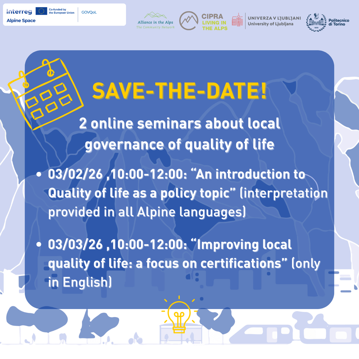
This good practice was presented during the 1st webinar organised by the GOVQoL project on February 3rd, 2026, dedicated to local strategies to improve quality of life.Download
-
This good practice was presented during the 1st webinar organised by the GOVQoL project on February 3rd, 2026, dedicated to local strategies to improve quality of life.Download
-
This good practice was presented during the 1st webinar organised by the GOVQoL project on February 3rd, 2026, dedicated to local strategies to improve quality of life.Download
-
This good practice was presented during the 1st webinar organised by the GOVQoL project on February 3rd, 2026, dedicated to local strategies to improve quality of life.Download
-
This good practice was presented during the 1st webinar organised by the GOVQoL project on February 3rd, 2026, dedicated to local strategies to improve quality of life.Download
-
This good practice was presented during the 1st webinar organised by the GOVQoL project on February 3rd, 2026, dedicated to local strategies to improve quality of life.Download
-
This good practice was presented during the 2nd webinar organised by the GOVQoL project on March 3rd, 2026, dedicated to certifications availble for municipalities to improve quality of life.Download
-
This good practice was presented during the 2nd webinar organised by the GOVQoL project on March 3rd, 2026, dedicated to certifications availble for municipalities to improve quality of life.Download
-
This good practice was presented during the 2nd webinar organised by the GOVQoL project on March 3rd, 2026, dedicated to certifications availble for municipalities to improve quality of life.Download
-
This good practice was presented during the 2nd webinar organised by the GOVQoL project on March 3rd, 2026, dedicated to certifications availble for municipalities to improve quality of life.Download
Project calendar