Overview
Why is it important to integrate biodiversity, climate adaptation and ecological connectivity issues into the spatial planning systems and territorial policies of the Alpine countries? Effects of human activities, infrastructures and climate change increasingly endanger habitats and ecosystem functions. Protected areas are essential for preservation of biodiversity and ecosystems. To be effective, they need to be connected by “ecological corridors” to form a coherent network of green and blue infrastructures. The network consists of e. g., rivers, wetlands, meadows, and forests, allowing gene flow, migration and adaptation of species. The PlanToConnect project partners will cooperate with stakeholders in pilot areas to develop and test an Alpine spatial planning strategy for ecological connectivity, and a capacity-building package for its implementation. The aim is to identify the key cross-border areas for planning of ecological connectivity and to facilitate the upgrade of spatial planning systems and territorial policies to preserve or re-establish them.
Factsheet
- 2021 – 2027
- Climate resilient and green Alpine region
- SO 1.2 - Enhancing protection and preservation of nature, biodiversity and green infrastructure, including in urban areas, and reducing all forms of pollution
-
- AG7 Ecological connectivity
- 11/2022
- 10/2025
- 2.461.927 EUR
- 1.846.446 EUR
Partners
- Lead partner
- Slovenia
- Zahodna Slovenija (SI04)
- Ljubljana
- Andrej Gulič
- andrejg@uirs.si
- Italy
- Veneto (ITH3)
- Venezia
- Claudio Perin
- claudio.perin@regione.veneto.it
- France
- Rhône-Alpes (FRK2)
- Chambéry
- Guido Plassmann
- guido.plassmann@alparc.org
- France
- Rhône-Alpes (FRK2)
- Annecy
- Marie Gourbesville
- marie.gourbesville@cen-haute-savoie.org
- Italy
- Provincia Autonoma di Bolzano/Bozen (ITH1)
- Bolzano
- Filippo Favilli
- filippo.favilli@eurac.edu
- Germany
- Oberbayern (DE21)
- München
- Florian Lintzmeyer
- florian.lintzmeyer@ifuplan
- Germany
- Unterfranken (DE26)
- Würzburg
- Hubert Job
- hubert.job@uni-wuerzburg.de
- Austria
- Salzburg (AT32)
- Salzburg
- Philipp Vesely
- philipp.vesely@salzburg.gv.at
- Austria
- Kärnten (AT21)
- Klagenfurt
- Michael Huber
- huber@e-c-o.at
- Italy
- Lombardia (ITC4)
- Milano
- Ana Cecilia Rivera Alvarado
- anacecilia.rivera@fondazione.polimi.it
- 46.043012814.50522085
- 45.437190812.3345898
- 45.5638749999999965.925742711213934
- 45.89923486.1288847
- 46.494530211.3472734
- 48.15105211.5788014
- 49.78235639.9667972
- 47.82263313.0391533
- 46.62394314.3075976
- 45.47780839.2272468
Outcomes
-
Alpine planning strategy for ecological connectivity, harmonized and integrated planning of GBI networks in priority areas
DownloadComprises guidelines to harmonize GBI networks design within common priority areas, that spatial planning authorities at all levels across the AS can apply to develop a coherent alpine wide GBI network for EC. Proposes an integrated approach to GBI networks implementation, identifies typology of spatial planning instruments/procedures to be considered for its realization and provides guidance on uses that may support/threaten connectivity functions, including RES. Inputs from WP2 and A3.3. -
Case studies of integrated planning of GBI connectivity networks in pilot sites across administrative boundaries and cross-border areas
DownloadThe pilot action consists of conducting several case studies demonstrating in PPs pilot sites of alpine strategic planning areas (A1.1) the applicability of O1.1. Case studies are examples of integrated GBI network planning approaches for ecological connectivity for the creation of GBI network for connectivity at regional/local levels across administrative boundaries and cross-border areas contributing to the implementation of the Alpine planning strategy for ecological connectivity. -
Training and capacity building system on integrated spatial planning of GBI networks for ecological connectivity
DownloadA comprehensive capacity building and training package is created to guide planning authorities at regional/local level in the design of BGI networks for connectivity. Includes e-modules, technical toolkit and tailored training sessions. Close contact to universities and professional associations to meet the needs of the state-of-the-art spatial planning education. Strong cooperation with AlpPlan network ensures long-term dissemination to stakeholders in the entire Alpine Space.
Pilots
-
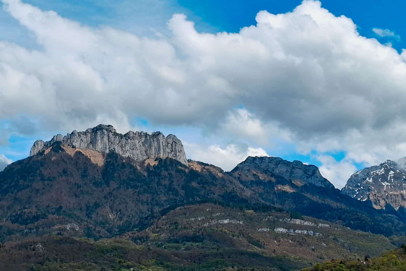
Trilateral transboundary pilot site (Austria-Italy-Slovenia)
The purpose of this case study is to create a harmonized transboundary Green Infrastructure (GBI) network connecting loose ends and different corridor approaches, serving as a basis for transboundary cooperation and enhancing transboundary conservation coordination. Simultaneously, the study aims to establish administrative and technical contacts for exchange and coordinated spatial development in the area. The technical proposal seeks to exemplary address key bottlenecks and gaps based on ongoing and future developments, including better integration of the GBI network into local planning, highlighting existing spatial planning instruments suitable for integration, and establishing mechanisms for transboundary coordination.
The geographical scope of the study covers the cross-border area encompassing Prealpi Guilie Nature Park (and Julian Alps Biosphere Reserve), Triglav National Park (and Julian Alps Biosphere Reserve), Dobratsch Nature Park, and the municipalities in these areas. Current barriers and expected typologies of threats to connectivity conservation and restoration areas include infrastructural developments that fragment the territory, such as linear traffic infrastructure (highways, railways) and settlements (expansion, industrial area development). Potential threats include wind park developments and agri-photovoltaic projects. Other direct pressures on habitat arise from intensive development, including soil sealing in the vicinity of municipalities, industrial development, and potentially intensified agriculture in valley areas and intensive forestry, particularly in Austria. Indirect pressures or contributing factors include the development of the Alpe-Adria economic space through railway and economic cooperation. Climate change pressures on habitats include increased natural disasters such as wind breaks, bark beetle infestations, wildfires, and floodings due to heavy rainfalls, particularly in mountainous areas with steep slopes.
The connectivity objectives are to develop a harmonized transboundary GBI network map as a common working basis and tool to support transboundary coordination of ecological connectivity and conservation. This involves identifying gaps and barriers based on national corridor systems using the SACA approach. The network proposal should also include development hotspots threatening connectivity and propose corresponding solutions, such as subprojects and spatial planning instruments, as well as mechanisms for transboundary coordination. The current status of connectivity in the pilot territory indicates comparatively good connectivity throughout the area due to low population density, remote areas, and many protected areas. Gaps and barriers are mostly limited to spaces in the valleys near settlements. -
Tennengau and Flachgau regions in Salzburg, with a particular focus on St. Gilgen
The case study for the municipality of St. Gilgen aims to develop an Integrated Urban Development Concept (ISEK) that balances urban growth with the preservation of green spaces. The central focus is on maintaining a regional green corridor that runs through the municipal area while implementing measures for inner densification to reduce pressure on open spaces. The plan targets creating a sustainable and liveable environment by harmonizing urban development with green area conservation.
The geographical scope of ISEK is primarily municipal, focusing on the unique needs and dynamics of St. Gilgen. The strategies developed will be specific to the local context, addressing urban development, green space management, and other factors crucial to the sustainable growth of the municipality. However, there are several barriers and threats to connectivity conservation and restoration within the area. These include infrastructural developments that fragment the territory, such as the construction of dams and roads, which challenge the continuity of ecological corridors. Additionally, human-induced actions like unsustainable logging, intensive agriculture, and tourism pressure pose direct threats to habitat connectivity. Indirect pressures, such as economic demands, lack of ecological awareness, and insufficient enforcement of conservation measures, further exacerbate these challenges. Climate change also looms as a significant pressure, potentially altering habitat suitability, vegetation patterns, and species distribution, which could undermine the effectiveness of the green corridors.
The connectivity objectives within the ISEK will be tailored to St. Gilgen's specific characteristics, focusing on key aspects of urban development and environmental conservation. The analysis will integrate the municipality into the local connectivity network, enhancing ecological processes and supporting target species. The priorities set within the ISEK will emerge from a thorough analysis of St. Gilgen's unique landscape and urban planning needs, ensuring a cohesive approach to connectivity within the municipal context. -
Illertal south of Kempten
The case study focuses on improving ecological connectivity across the valley of the Iller river south of Kempten through the establishment of a Green Infrastructure (GBI) connectivity network. It aims to develop a proposal for future local management of connectivity networks based on a thorough analysis of local threats and network design. The geographical scope of the study encompasses the inter-municipal area comprising Weitnau, Buchenberg, Waltenhofen, Sulzberg and Durach.
The pilot region is in the northern part of the district “Oberallgäu”. This sub-region was selected due to its importance in connection with the Alpine-wide ecological network system and because of the comparatively small to almost non-existent biotope network system in contrast to the southern section of the district “Oberallgäu”. Current barriers and expected threats to connectivity conservation and restoration areas include infrastructural developments that fragment the territory, such as higher-ranking road infrastructure (B12/B19 and A7/A980, railway Kempten-Lindau), linear settlement expansion along the Iller valley south of Kempten. Additionally, direct pressures on habitats stem from intensive agriculture (grassland), tourism and recreation, and traffic. Indirect pressures such as the impacts of climate change on habitats also pose significant challenges.
The objective in the pilot region is to design a GBI network for connectivity and to identify priority areas for conservation and restoration efforts (spatially and thematically), which could in a next step be incorporated into regional spatial concepts. -
Planungsregion 17 «Oberland«
As a pilot area, the analysis considers the Bavarian planning region No. 17: Oberland, due to its spatially and structurally interesting extension from north to south, from the Munich surrounding area to the Bavarian Alps. The case study carried out as part of the “PlanToConnect” project deals in particular with the analysis of the (regional planning) instruments available in Bavaria as well as complementary measures for the conservation and development of the biotope network. The spatial and content-related design options and limitations of these instruments are investigated using project analyses on the basis of ecological corridors, among other things, and thus exemplary further development options for future regional planning are identified.
The involvement of various stakeholder groups is important for the implementation of the case study. To this end, workshops and bilateral expert discussions are held in which stakeholders can contribute their expertise in the various specialist areas. Stakeholder participation also serves to coordinate with the specialist areas concerned and to facilitate simultaneous technical discussions on interrelated topics (such as biodiversity, climate change, agriculture, natural hazards, tourism/local recreation, energy transition, rural development, etc.).
The result of this process will be an analytical basis for regional planning with the aim of making an applicable contribution to improving the connectivity of green infrastructure - in the sense of a large-scale, ecologically effective open space system - in the Oberland pilot region. -
Alpine Space
The aim of this case study is to analyze the ecological network at the Alpine level, focusing on areas identified as priorities for spatial planning. This includes the analysis of the current land use, the degree of spatial development, demographic impacts on landscapes, urban sprawl, and other factors, addressed to identify the suitability for integrate the ecological network, identifying main barriers, and proposing potential actions and solutions to be integrated into spatial planning to improve connectivity within the Alps and its interface with the EUSALP space.
This work builds upon the results of current actions and previous projects on ecological connectivity conducted by ALPARC over the past 25 years. The network of Alpine protected areas covers nearly 30% of the Alpine Convention's protection perimeter, highlighting its crucial role in preserving, restoring the connectivity network and achieving the 30x30 conservation goal within the Alps. The case study underscores the importance of reinforcing and restoring corridors and developing common strategies that allow to also reach non-protected areas to ensure habitat connectivity. This is one of the most critical factors in preserving biodiversity for future generations in the Alps and beyond. -
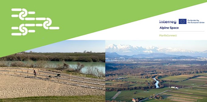
South of Lake Annecy
The study, design and monitoring of the green and blue infrastructure network will be carried out around Lake Annecy which is made up of several protected natural areas which need to be connected to each other.
The issue is even more important as the corridors which connect the natural spaces are identified as important at the regional level.
The PlanToConnect project, aimed at studying and characterizing the landscape frameworks, will make it possible to better understand the issues of ecological connectivity on the pilot site and consequently to define restoration measures adapted to improve the attractiveness of habitats and the functionality of corridors.
Asters plans to carry out a study of ecological connectivity and the functionality of eco-landscape networks. This involves modeling using GIS a connectivity network in the pilot site around Lake Annecy, considering the connectivity objectives at the alpine scale. This work, in connection with the RECO-Crapauds project, will be accompanied by site visits, to finally, take the form of a cartographic report identifying the landscape elements connecting the protected natural areas which border the Lake. The objective is to better understand the issues of ecological connectivity on the pilot site and to design operational measures to improve the attractiveness of habitats and the functionality of corridors. -
South Tyrol
The purpose of this case study is to develop a Green Infrastructure (GBI) connectivity network in the Autonomous Province of Bolzano - South Tyrol, addressing the absence of a formal or informal Ecological Connectivity (EC) concept in the region. The study aims to propose an EC concept for the new provincial territorial strategic plan, utilizing the macro-regional structural model of the PlanToConnect project. Specifically, it analyzes the ecological connectivity for target species at the provincial level to formulate a detailed proposal for the new provincial landscape guidelines. Furthermore, the study focuses on implementation measures to integrate ecological linkages into the municipal development program.
The geographical scope of the study encompasses the Autonomous Province of Bolzano – South Tyrol, with consideration given to connections to surrounding regions. Current barriers and expected threats to connectivity conservation and restoration areas include infrastructural developments that fragment the territory, particularly in the valley bottoms. These developments include transportation infrastructure such as roads and railways, with four motorway barriers identified for macro-corridors. Urbanization processes pose threats to four macro-regional linkages. Additionally, direct pressures on habitat arise from intensive agriculture practices in valley bottoms, especially in the Adige Valley and Val Venosta, where agricultural intensification has extended approximately 15 km in the last 70 years, creating a growing barrier. Ski resorts and tourism activities at higher altitudes also contribute to habitat degradation. Indirect pressures or contributing factors include cultural and economic factors, such as land use conflicts with agriculture or tourism, which could potentially impede the implementation of measures for connections of green infrastructure. Furthermore, a lack of resources in specific planning offices to dedicate time to this topic is identified as a challenge. -
Province of Sondrio, Lombardy
The case study concerning the Province of Sondrio aims to define a strategic design of a multifunctional green and blue network, specifically addressing the area between Morbegno and Tirano. The main purposes guiding the project are the enhancement of the transalpine ecological network continuity promoted by the PlanToConnect project and the alignment with the objectives and strategic guidelines set by the main territorial planning tools that rule connectivity, biodiversity, and environmental degradation at various levels (regional, provincial, local). The territory, encompassing the catchment of the first course of the Adda river and corresponding to the geo-historical region of Valtellina, is characterized by a wealth of natural resources and widespread landscape features, covered by over 40% of highly valuable protected areas, benefiting from its strategic position within the Retiche Alps.
Despite the recognized ecological-environmental and landscape value of this context, certain elements and anthropogenic activities mainly located in the Adda and lateral valley floors (such as medium and large-scale infrastructures, impactful settlements, or new urban development plans) pose potential threats, contributing to habitat fragmentation and the deterioration of widespread ecological connectivity. Direct pressures on habitat arise from tourism, particularly related to winter tourism, with a high density of ski resorts and accommodation facilities, and the presence of linear conurbation trends, industrial and commercial settlements, especially on the valley floors. While indirect pressures or contributing factors include the abandonment of traditional mountain activities such as agriculture and forestry. Another important factor of environmental pressure is done by the presence of several dams and waterpower plants in the high mountain area.
The mapping and assessment of Ecosystem Services in territorial and landscape planning helps to identify both vulnerabilities and services provided by ecosystems. This supports the association of actions, strategies, and nature-based solutions to maintain or enhance the quality of the territory. In parallel with the identification and spatialization of provincial-scale action priorities, the project also aims to promote collaborative processes among local and supra-local stakeholders, seeking to provide specific information and tools on ecological connectivity to the competent local authorities. Moreover, the project is conducted in parallel with the ongoing review process of the PTCP (Provincial Territorial Coordination Plan) currently underway. The outcomes of the PlanToConnect project for the pilot case could therefore serve as a potential contribution to the strategic design of the green network and ecological network envisaged by the PTCP itself.
The connectivity objectives in the province of Sondrio are to identify key multifunctional connectivity areas and paths based on natural, rural, and historical/cultural values, while taking into account existing tools provided by multi-level plans. Therefore, the comprehensive objective is to foster the progressive integration of multifunctional green infrastructure design across different scales within the existing planning tools, promoting biodiversity enhancement, habitat protection, and the safeguarding of landscape value systems within the pilot case. -
Wetlands of the Caorle lagoon system
The case study involves multi-actor governance, spatial planning and policy instruments to show how connectivity can contribute to biodiversity maintenance and multi-functional use in the wetland systems of the municipalities of Caorle, San Michele al Tagliamento and Concordia Sagittaria currently managed under the governance setting of a voluntary agreement - “Wetland Contract” - to regulate the use of natural capital.
The area is characterized by a vast network of natural and artificial waterways, the latter connected to the reclamation system. The Contract aims to find integrated and shared solutions for the protection and enhancement of the natural capital in the territory of the “Caorle Lagoon System” and is in the process of extending its territory to neighboring municipalities that are interested by the conservation and restoration measures of ecological connectivity resulting from the case study. A dialogue with stakeholders will particularly focus on green and blue infrastructure (GBI) networks, ecosystem services and conservation and restoration of ecological connectivity.
In the GBI networks approach, connectivity is understood as a proxy measure for the provision of potential ecosystem services, as it influences the supply and flow of services in a landscape. The stakeholder dialogue will focus on integrated spatial planning and the contribution of existing governance structures and citizen-supported projects to the planning and realization of multifunctional GBI networks for the implementation of a Transalpine and Trans-European Network for Nature (TEN-N), considering the connectivity of wetland systems under climate change. -
Goriška statistical region/Intermunicipal area Tolmin, Kobarid, Bovec
The wider geographical scope of the case study is the Goriška statistical region; part of the activities will be implemented in a narrower, intermunicipal area of Tolmin, Kobarid, and Bovec.
The case study is firstly oriented into informing and raising awareness of stakeholders at the local and regional level about the significance of ecological connectivity and its integration into spatial planning instruments. This intention results from a perceived lack of recognition of the concept that characterizes the current situation in the pilot area, and the absence of the topic in the valid municipal spatial plans.
Green and blue infrastructure connectivity network will be addressed at the regional and municipal level. At the regional level, the elaborated materials should provide background to including ecological corridors into the regional spatial plan, and at the local level into (inter)municipal spatial plans.
Within the intermunicipal area of Tolmin, Kobarid, and Bovec, the aim is to connect the Natura 2000 areas Trnovski forest – Nanos (which includes the Upper Idrijca Landscape Park) and Julian Alps (which includes the Triglav National Park and the Julian Alps Biosphere Reserve).
Preliminary considerations of barriers and threats to connectivity conservation and restoration areas suggest that economic infrastructure, settlements, road infrastructure, and agricultural activities (especially cattle, sheep, and goat breeding) may pose significant challenges. Additionally, an increase in attacks by wild animals (such as bears, wolves, and jackals) on herds of livestock, both in protected and unprotected areas, has been observed, resulting in considerable damage to animal breeders.
Downloads
-
Download
The report contains firstly the procedure and results for mapping priority connectivity areas for spatial planning at Alpine-wide level. Secondly, it contains a barrier analysis in priority planning areas and insights to some regional specificities. Thirdly, a catalogue of typologies of GBI connectivity elements was produced. Finally, it provides some recommendations for providing a coherent ecological network in the Alpine Space through spatial -, landscape-, and transport planning.
-
Download
The Deliverable D1.1.2 of the Interreg Alpine Space PlanToConnect project features an Alpine-wide GIS model for landscape permeability and ecological connectivity. It includes an online visualization of identified bottlenecks, passages, and restoration areas, as well as a coarse analysis of motorway and railway barriers. The model, developed with Eurac Research and ALPARC, allows users to prioritize ecological linkages across the Alps, facilitating harmonization processes, particularly in border regions. It is available as downloadable and open data via the JECAMI platform, ensuring long-term accessibility. The model aids in selecting priority ecological linkages and understanding the impact of urbanization on connectivity. The visualization is interactive, allowing users to explore data on ecological corridors and barriers at a regional level.
-
Identification of the main compatible and incompatible anthropogenic uses posed to different GBI network elements in priority connectivity areas. Description of synergies and conflicting uses.Download
-
Identification of major emerging threats posed to GBI ecological networks integrity and connectivity function, focusing on increasing renewable energy production.Download
-
Policy Screening on alpine ecological connectivity, renewable energies and upcoming spatial needs.Download
-
Elaboration of an agreed protocol for all Alpine countries to assess and analyse GBI connectivity networks and their elements at the different planning levels.Download
-
The guide on procedural steps explains how to include GBI network priorities, knowledge and information into planning systems at all levels.Download
-
Analysis of planning practices on establishing GBI networks: good practices, challenges, opportunities. Transnational report.Download
-
Annexes of Planning instruments and processes for GBI network planning and implementation in the Alps (D2.1.1)Download
-
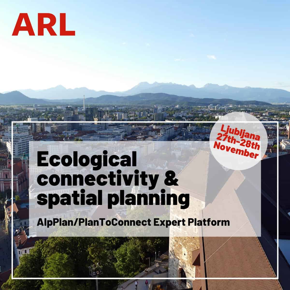
Strategic document outlining the scope, objectives and activities of the Transnational expert working group. It was adopted at the meeting/workshop of the Expert Platform in Ljubljana on 27 November 2023.Download
-
Folder with presentations from midterm workshop entitled Alpine Ecological Networks: Integrating Connectivity into Spatial Planning, hosted by The PlanToConnect project and the AlpPlan Network, in Obergurgl, Austria. Experts shared insights, and in two interactive sessions the participants contributed ideas to PlanToConnect project outputs, most notably the strategy for ecological connectivity planning in the Alpine region.Download
-
Poster presenting the project partner’s pilot area, activities and results developed within the project framework.Download
-
Planning and implementing Strategic Green and Blue infrastructure networks for ecological connectivity.Download
-
Mapping report identifying the GBI elements, barriers, connectivity measures in pilot areas.Download
-
Mapping report outlining GBI network elements and areas of land use conflicts for renewable energy production and other major threats. Includes evaluation criteria and mitigation measures for impact assessment.Download
-
Technical proposal for implementing a GBI connectivity network in spatial/sector plans of spatial planning authorities in pilot sites of strategic planning areas.Download
-
Planning and implementing Strategic Green and Blue infrastructure networks for ecological connectivity.Download
-
Poster presenting the project partner’s pilot area, activities and results developed within the project framework.Download
-
Mapping report identifying the GBI elements, barriers, connectivity measures in pilot areas.Download
-
Mapping report outlining GBI network elements and areas of land use conflicts for renewable energy production and other major threats. Includes evaluation criteria and mitigation measures for impact assessment.Download
-
Technical proposal for implementing a GBI connectivity network in spatial/sector plans of spatial planning authorities in pilot sites of strategic planning areas.Download
-
Poster presenting the project partner’s pilot area, activities and results developed within the project framework.Download
-
Planning and implementing Strategic Green and Blue infrastructure networks for ecological connectivity.Download
-
Mapping report identifying the GBI elements, barriers, connectivity measures in pilot areas.Download
-
Mapping report outlining GBI network elements and areas of land use conflicts for renewable energy production and other major threats. Includes evaluation criteria and mitigation measures for impact assessment.Download
-
Technical proposal for implementing a GBI connectivity network in spatial/sector plans of spatial planning authorities in pilot sites of strategic planning areas.Download
Project calendar