")
On January 17, the H2MA project partners joined into an online meeting to discuss on the developments made for the H2MA Tool.
But, what is the H2MA tool? And how does it work?
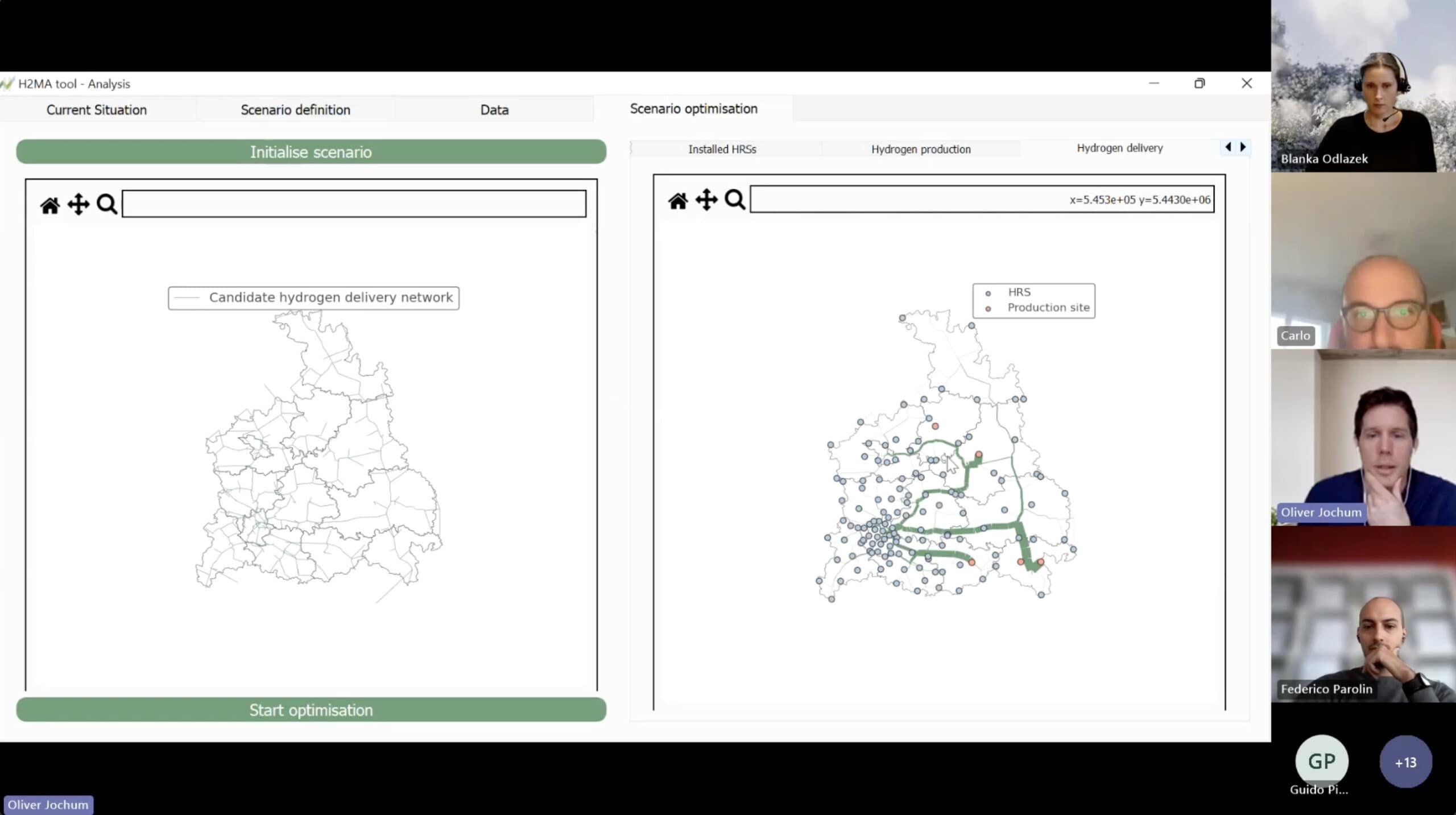
The main scope of the tool is to support local authorities in the design of infrastructure networks for green H2 mobility in the Alpine Space area, as well as the optimization of key node locations (e.g., hydrogen power plants and hydrogen refueling stations).
The starting point of the H2MA Tool is the development of a geographic portal where users can find information regarding the current situation of sites with good potential for green hydrogen production and the construction of Hydrogen Refueling Stations. The geographic portal is based on a Geographic Information System (GIS), and it can also associate each data with a unique geographic location allowing to process information at a geographical scale.
The GIS datasets contain three levels of information managed in a relational database that can be exported or imported through the processing of standard formatted files. GIS technology is highly advantageous and can use open-source programs and platforms. As the use of open source and standard file formats does not require additional software development, H2MA data and information will be available for public use beyond the duration of the project.
Finally, the tool presents three main layers of preloaded information (infrastructure, demand, development/research strategies) and combines geographic data with textual and numerical information. The combination of information from the three main layers allows the creation of a database that can provide final information output, indicating the readiness of a location to host an H2 production plant and/or the implementation of HRS.
In summary, the collaboration within the H2MA project is giving life to a powerful planning tool. Focused on aiding local authorities, the tool utilizes a Geographic Information System (GIS) to create a user-friendly portal, providing crucial information about potential sites for green hydrogen production and Hydrogen Refueling Stations (HRS).
The use of open-source technology ensures accessibility for public use beyond the project’s duration. With three main layers of preloaded information, the tool generates a comprehensive database, offering a clear indication of a location’s readiness for hosting hydrogen production plants or implementing HRS.
This marks a significant step towards a more sustainable, accessible and resilient green hydrogen mobility.