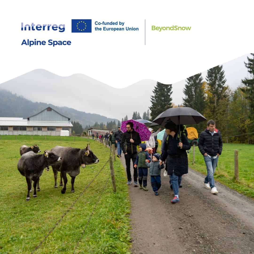
Overview
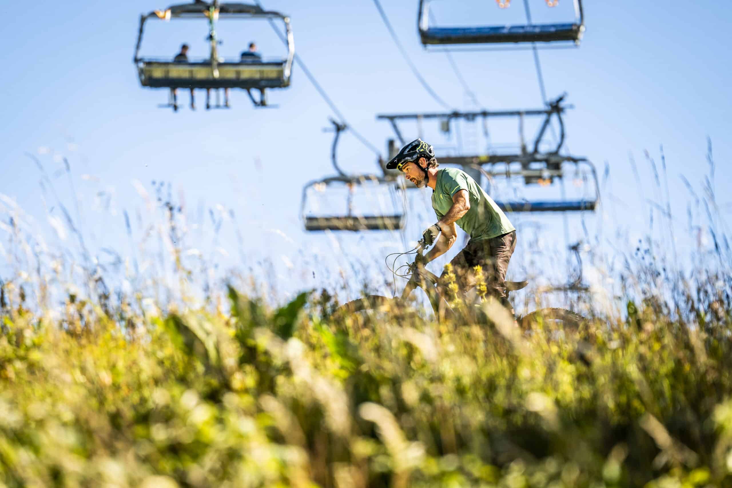
Due to climate change, snow coverage in the Alps continues to decrease slowly each year. In addition to the ecological impacts, especially small medium-altitude snow tourism destinations and their communities must consider the socio-economic consequences of the diminishment of snow coverage. The project BeyondSnow aimed to increase the socio-ecological climate resilience of snow tourism destinations to enable them to retain or even increase their attractiveness for residents and tourists.
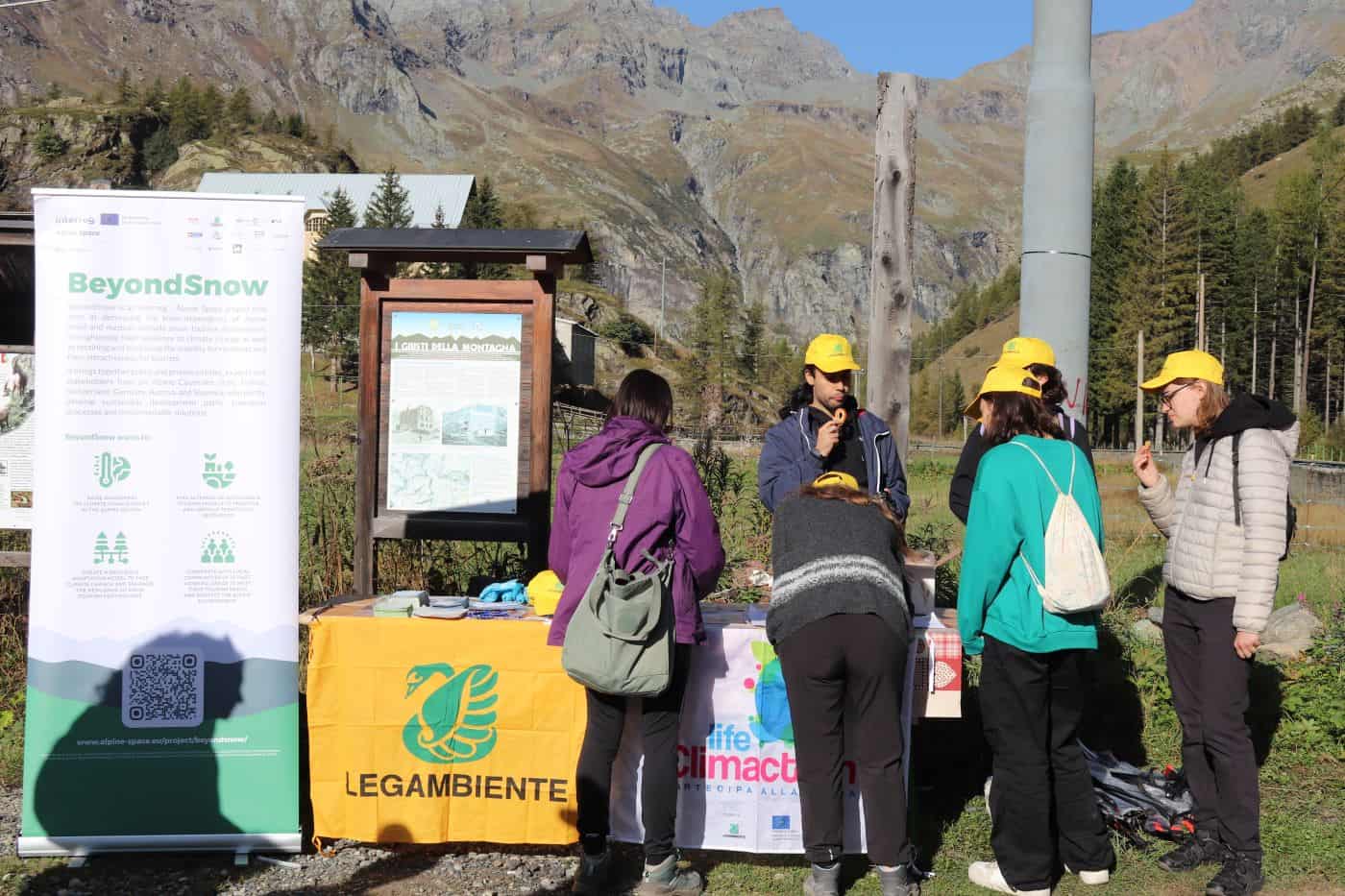
During the project new sustainable development paths, transition processes, and implementable solutions were conjointly devised within ten specific pilot working areas (PWAs), spatially distributed across six Alpine countries, differing in size, development level and criticalities. Thanks to trainings and awareness-raising activities, citizens and decision-makers at the different technical and political levels were involved in this process.
Furthermore, the project partners developed an innovative and easy to use Resilience Decision-Making Digital Tool, which was made freely available and publicly accessible throughout the Alpine community.
Factsheet
- 2021 – 2027
- Climate resilient and green Alpine region
- SO 1.1 - Promoting climate change adaptation and disaster risk prevention, resilience, taking into account eco-system based approaches
-
- AG2 Economic development
- AG3 Labour market, education and training
- AG5 Connectivity & accessibility
- AG6 Natural resources
- AG8 Risk governance
- 11/2022
- 10/2025
- 2.720.730 EUR
- 1.944.473 EUR
Description
Project Manager: Andrea Omizzolo - Eurac Research: andrea.omizzolo@eurac.edu
Project Manager: Philipp Corradini - Eurac Research: philipp.corradini@eurac.edu
Communication Manager: Cinzia Peschechera - Legambiente Lombardia: cinzia.peschechera@legambientelombardia.it
Partners
- Lead partner
- Italy
- Provincia Autonoma di Bolzano/Bozen (ITH1)
- Bolzano-Bozen
- Andrea Omizzolo
- andrea.omizzolo@eurac.edu
- Italy
- Lombardia (ITC4)
- Milano
- Simona Colombo
- simona.colombo@legambientelombardia.it
- Italy
- Piemonte (ITC1)
- Turin
- Federica Corrado
- federica.corrado@polito.it
- Italy
- Piemonte (ITC1)
- Turin
- Elena Di Bella
- elena.dibella@cittametropolitana.torino.it
- Italy
- Friuli-Venezia Giulia (ITH4)
- Tolmezzo
- Michele Colusso
- michele.colusso@carnia.comunitafvg.it
- Austria
- Kärnten (AT21)
- Weissensee
- Giovanni Vassena
- giovasse@gmx.net
- Slovenia
- Zahodna Slovenija (SI04)
- Jesenice
- Jelka Popović Gužvić
- jelka.popovic@ragor.si
- Slovenia
- Zahodna Slovenija (SI04)
- Nova Gorica
- Jedrt Mikelj
- jedrt.mikelj@arctur.si
- Germany
- Niederbayern (DE22)
- Deggendorf
- Marcus Herntrei
- marcus.herntrei@th-deg.de
- France
- Franche-Comté (FRC2)
- Metabief
- Claire Leboisselier
- claire.l@smmo-metabief.com
- Switzerland
- Espace Mittelland (CH02)
- Bern
- Peter Niederer
- peter.niederer@sab.ch
- Germany
- Oberbayern (DE21)
- Übersee
- Katharina Gasteiger
- katharina.gasteiger@alpenallianz.org
- France
- Ile-de-France (FR10)
- Paris
- Benoît Nenert
- benoit.nenert@fabriquedestransitions.net
- 46.494530211.3472734
- 45.4996989.226216
- 45.06297217.6624557
- 45.06879737.662731
- 46.405517713.0111712
- 46.7188543513.288863904285206
- 46.4423416514.028244712488505
- 45.956739213.66347219569659
- 48.829554412.954735008965425
- 46.7682936.357125
- 46.94680587.4353275
- 47.836164212.4884359
- 48.85787812.3694829
Outcomes
-
Final version of the Resilience Adaptation Model (RAM)
DownloadBased on data collected and results of WP1 actions, specific in-depth analyses of each PWA, and collected scientific literature, the final version of the RAM encompasses the theoretical, methodological, and practice-oriented basis for the assessment, development and strengthening of Alpine STD resilience to CC. Its primary objective is to function as a STD resilience guideline for PWA and AS practitioners, its secondary is to serve as the conceptual basis for the RDMDT in WP2. -
Resilience Decision-Making Digital Tool (RDMDT)
WebsiteThe RDMDT is the digitalized version of the RAM. It represents an automated assessment tool for aware decision-making of local and regional authorities, development agencies & local stakeholders. It enables tourism stakeholders to gain an initial understanding of their destinationís local characteristics, data and resources in relation to climate change, which are essential for the development of future options and scenarios as well as climate change transition strategies and adaptation measures. -
PWA Transition Strategies
DownloadThe PWA Transition Strategies serve as blueprints for the initiation and continuation of the transition processes within PWAs for decreasing the snow-dependency of their respective tourism systems, strengthening their resilience regarding CC-induced ecologic & socioeconomic effects. This output includes an overview of the CC adaptation measures developed in each PWA as well as a summary of the processes undertaken for their development. -
Pilot Actions for RDMDT implementation and resilience enhancement of the PWAs
DownloadBy involving local communities & stakeholders, the PAs aim at field-testing and fine-tuning the RDMDT, as well as developing transition strategies and implementing concrete actions on experimental basis in 10 PWAs. Each PWA is managed by a PP. PAs will be developed and implemented jointly with the aid of all PPs and the supervision of Observers. -
Resilience-oriented policy guidelines for AS STDs
DownloadBased on the theoretical and practical findings (WP1) and experiences gained within the PWAs (WP2), BeyondSnow delivers specific CC adaptation- and resilience-oriented policy guidelines for AS STDs, targeting tourism actors and decision-makers such as e.g., DMOs and regional development agencies. The guidelines also consider the introduction and utilization of the RDMDT (WP2 & WP3) within the decision-making processes of these TGs. -
Policy recommendations for Alpine Convention, EUSALP & EU
DownloadThe policy recommendations meet the Alpine Convention working group results on CC strategies including Alpine Convention ACB working group and Climate Action Plan 2.0. The recommendations guarantee a result transfer towards EUSALP, especially towards AGs 2, 3 and 6, as well as contributing to the further development of the EUSALP action plan. On the EU-level policy recommendations are developed in the light of the EU strategy for Sustainable Tourism.
Pilots
-
Piani d'Erna (Lecco, Como Lake - Italy)
Piani d'Erna is a mountain locality at an altitude of 1350 m, formed by grassy slopes and broadleaf forests, overlooking the city of Lecco and offering one of the most beautiful views of the Lecco branch of Lake Como and its mountain ranges.
Situated at the foot of the rocky cliffs of Mount Resegone, it has no road accessibility but can be reached by a comfortable cableway from Lecco, which operates a permanent local public transport service, as well as a network of trails that connect it to the city. Hiking trails also connect it to the village of Morterone (33 inhabitants, the smallest municipality in Italy) and to the Taleggio and Imagna Valleys (BG), tributaries of the Brembana Valley, rich in historical, ethnographic and geological heritage. From Piani d'Erna, there are also paths and mountaineering routes that lead to the peaks and refuges of Resegone.
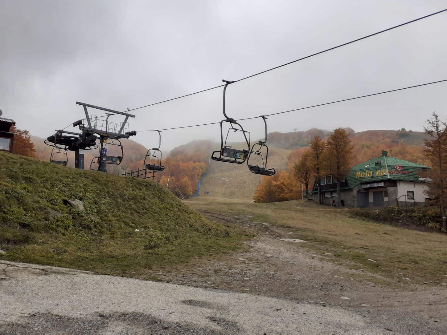
In the 1960s, the locality became the subject of an ambitious tourist infrastructure project for which it was to rise, together with the cable car (built in 1965), a sort of 'satellite town' of Lecco dedicated to winter sports. As part of this project, ski lifts and slopes were built. In 1993, the company went bankrupt, which prevented the realisation of the building projects. The downhill skiing facilities, all located at altitudes below 1,500 metres above sea level, operated until 2005, and were dismantled by the municipality of Lecco in 2020.
Today, the locality certainly deserves to receive planning attention to develop its tourist potential and to enhance its position between the Lake Como and the Orobic mountains. -
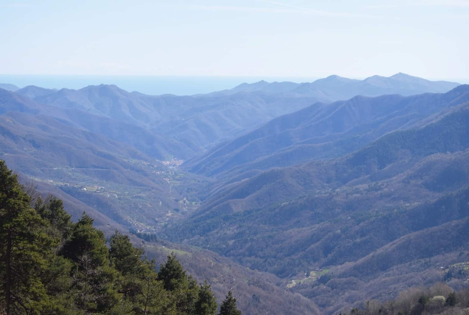
Monesi di Triora (Ligurian Alps - Italy)
The territorial context of the ski area of Monesi di Triora is heterogeneous and articulated; the orographic conditions have three main areas: the Ligurian coast, the many Apennine valleys and mountain areas with peaks above 2000 m.
The main urban centers are in ligurian coast (Imperia, Sanremo, Ventimiglia) while the mountain hinterland has many small urban towns. The most developped economic sectors are tourism and services in coastal areas while agriculture connotes mountain landscapes.
The Alpi Liguri Regional Park, founded in 2007, is located on the border between Liguria and Piedmont and protects the highest and most marginal mountain areas.
The Monesi ski area, extended from 1389 m to 2164 m, develops near the protected area of the Alpi Liguri Regional Park, has a fragile relationship with environmental components of the context. In recent years, the ski resort has been in decline due to unfavourable economic conditions, difficulties of accessibility, changes of climate change and tourism sector.
The aim of local Institutions is to improving local opportunities, to developing the relationship between Monesi ski area with the resources of the Park, to redefine the tourist proposal and to generate more integrated local development.
-
Ala di Stura e Balme (Lanzo Valleys - Italy)
The steep, narrow and wild Val d’Ala is closed at its head by the mountain range of Bessanese (3,604 m above sea level) and Uia di Ciamarella (3,676 m above sea level) on the border with France.
The road reaches an altitude of 1,750 m above sea level in a wide grassy basin, Pian della Mussa, a site of “Rete Natura 2000”, where abundant spring waters feed the important valley aqueduct.
The Ala di Stura stream is partially fed by glaciers (in regression) and forms a gorge, Gorgia di Mondrone, in which the waters cascade in two jumps. Some secondary streams form high waterfalls.
The valley presents different types of mountain environments (chestnut groves, beech woods, larch woods, meadows, pastures, scree) and is a destination for hiking tourism, thanks to medium mountain trails, the presence of refuges, numerous alpine lakes and panoramic viewpoints. It is a destination for mountaineering tourism that aims for the ascent of peaks or rock climbing sites. It is crossed by a well-known itinerary, the Great Alpine Crossing, and a high-altitude cross-border trek, the Tour of Bessanese.
In the winter months, attractive activities are represented by downhill skiing slopes, a circuit for cross-country skiing and snowshoeing and an ice-skating rink.
In Ala di Stura, a chairlift, now not in operation, departs from 1,000 m and rises to 1,450 m. There are two ski lifts and a carpet lift serving the slopes, of which 5.3 km are equipped with artificial snow.
In Balme, there is a ski slope for beginners, a cross-country skiing track, and a path dedicated to hikers with snowshoes.
During the summer, recreational activities and tourist services are organized (e-bike rental, guided hikes). In Ala di Stura, there is a fishing reserve: a “No Kill” stretch, a catchment area and an area dedicated to disabled people. The valley has a heritage of Liberty-style buildings, the Museo delle Meridiane in Ala di Stura, the Ecomuseo delle Guide Alpine in Balme, and the Aula-museo della Scuola di Martassina.
Ala di Stura (1,080 m above sea level and 467 inhabitants) is a tourist center located halfway up the valley. This town was first mentioned in 1267 when the Marquis of Monferrato granted the local mines. It is known as the "Town of Sundials and Frescoes": it has about 76 sundials, many of which were built in the second half of the 19th century.
Balme (1,432m above sea level and 105 inhabitants) is an historic holidays resort and is the last inhabited village in the valley. It was a mining center in the 13th century and became an autonomous municipality in 1610. It is the cradle of Piedmontese mountaineering, known as the town of "Alpine guide"s. -
Pradibosco (Prato Carnico - Italy)
Pradibosco ski lift, located in Pradibosco, in the Municipality of Prato Carnico, Friuli Venezia Giulia, Italy, is located between 1,135 and 1,245 mt a.s.l, with one ski lift approximately 800 meters long, is placed near a large hotel structure. It was renewed in 2018, after years of downtime (for safety reasons) and reactivated in January 2023 (after the Vaia storm and the COVID 19 epidemic).
The influence of the plant is almost entirely limited to Prato Carnico, a Municipality of about 900 inhabitants located in the northern part of the Region, especially due to its very small size, but also because of its geographical position, far from the centers of adjacent Municipalities as well as from the ski resorts in the area. As a matter of fact, Prato Carnico extends along the Pesarina creek, in a west-east direction for about 22 km. In the northern part of the valley there are the mountains of the Pesarine Dolomites. It borders - from west to east - with the Comelico of Belluno and with the Municipalities of Sappada, Forni Avoltri, Rigolato, Comeglians, Ovaro and Sauris. It consists of the towns of Avausa, Croce, Osais, Pesariis, Pieria, Prato, Pradumbli, Prico, Sostasio and Truia.
The pilot area is also characterized by original cultural resources and natural attractions.
With regard to the first ones, in addition to the typical architecture and the presence of a historic "administration of common goods", the area is known as a valley of ingenious artisans, also denominated ‘the Valley of Time’. The Watchmaking Museum (Museo dell’Orologeria), located in Pesariis, collects watches of different types that bear witness to almost three hundred years of history of an activity that still represents an important reality. The monumental clocks created over the years are still visible in the towers of the regional chief towns and in numerous squares of Istria and Veneto, while a modern one is exposed at the MOMA museum in New York. In Pesariis, there is also the so called Casa Bruseschi, a typical middle-class house in which tools, furniture, fabrics and manuscripts are perfectly preserved, allowing us to reconstruct the history of local life until the 15th century.
Furthermore, in Pieria, there is the Small historical museum of photographic and cinematographyc machines (Piccolo museo storico delle macchine per la fotografia e la cinematografia), that includes some rarities such as the two Arriflex cameras used by Pier Paolo Pasolini.
Regarding the natural resources, the area is rich in naturalistic itineraries (such as the ascent to Mount Talm, the walk from Pesariis towards the Fuas waterfall, the trail towards Noldedas and the walk towards Orias). There is also a cross-country skiing trail, with routes of varying difficulty and length. -
Werfenweng (Tennengebirge - Austria)
Werfenweng is a municipality in Salzburg with 1099 inhabitants, nestled in the Tennengebirge mountains. The village lies at an altitude of 902 m, while the winter sports area lies at an altitude of 902 to 1.834 m.
Weather conditions in Werfenweng are characterized by a cold and moderate climate. The precipitation levels are noteworthy, as there is a considerable amount of rainfall even during months that typically experience dry weather. Throughout the year, Werfenweng experiences a total precipitation of 1841 mm. In the month with the highest precipitation, June (212 mm), there is on average 103 mm more precipitation than in the driest month of February (109 mm). The average temperatures vary over the year by 20,1 °C between the warmest month of July (average temperature 14,1 °C) and the coldest January (average temperature -6°).
Tourism has played a key role in Werfenweng for many years. Its strategic location 45 km south of Salzburg and excellent rail connections, combined with the high-quality services developed for last-mile mobility and plenty of touristic attractions in the region, make Werfenweng a particularly attractive location for both a holiday and a day trip. Werfenweng has been a model village on the topic of soft mobility for more than 25 years and, as a member of Alpine Pearls, is committed to promoting sustainable tourism in harmony with the environment.
In summer, many attractive activities can be enjoyed in nature. Werfenweng offers many high-altitude hiking trails as well as relaxing walks on the edge of the village (the so-called “Spazierhimmel”). Further summer activities are paragliding, biking (MTB, e-bike), horse riding, tennis and water experiences at Lake Wengsee. For families, there is also the adventure park “Dein Berg” with a mountain cart, rope course, flying fox and much more.
In winter, alpine skiing is the most popular activity in Werfenweng. The ski area has about 29 km of slopes: 16 ski pistes, a snow park for kids called IKI’s Snow Park, 2 gondolas, 2 chairlifts, 5 skilifts, 1 carpet lift. Besides skiing, winter activities that can be enjoyed in Werfenweng include paragliding (very popular also in winter due to the particularly favourable updrafts), ski touring, cross-country skiing, snowshoe hiking, sledding, winter hiking, and horse sleigh riding.
Nevertheless, alpine skiing remains the main attraction for tourists in Werfenweng in winter, as well as the largest source of income for the tourism sector.
Climate change has repeatedly challenged operators regarding the length of the season and the possibility (as well as the costs) of guaranteeing perfect skiing conditions even during periods of scarce snow or high temperatures, especially on slopes at lower altitudes or more exposed to the sun. The winter of 2022-2023 was a particularly significant example.
Although it is clear that skiing will remain a fundamental segment of Werfenweng's tourist offer in the coming years, a medium- to long-term tourism development strategy must be drawn up now to reduce the tourism sector's dependence on the snow-skiing sector. This strategy should be able to guarantee not only environmental but also and above all economic and social sustainability.
-
Bohinj (Julian Alps - Slovenia)
Bohinj is an alpine valley in the Julian Alps, the highest mountain range in Slovenia. The bottom of the valley lies at 500 m, and the mountain range with the highest peak, Triglav, rises to a height of 2864 m. The majority of high mountain world lies in the area of the Triglav National Park. There are 5,676 inhabitants (2022) living in the area of the municipality of Bohinj, who mostly make a living from tourism. The area is known primarily for its unspoilt nature with the glacial Lake Bohinj and mountains with rich alpine flora and fauna, as well as a cultural heritage based on alpine grazing. All this is the basis for a rich tourist offer in the summer season, based mainly on outdoor and adrenaline experiences.
Although today Bohinj is visited by many more tourists in summer than in winter, it is still considered an important winter tourist center in Slovenia. There are 5 ski slopes in the area of the municipality, but they are not connected to each other. They have a total of 35 km of tracks and 17 cable cars. The biggest is the Vogel ski resort, whose ski slopes are located between 570 and 1800 m. The ski resort is entirely dependent on natural snow, as it is located in a protected area of the national park. The Soriška planina ski resort is slightly smaller at an altitude between 1270 and 1550 m. The other three ski resorts are smaller local ski resorts, intended primarily for families. One of them is the Kozji hrbet ski resort, a remnant of the once larger Kobla ski resort, which ceased operations in 2011 due to a lack of snow. Pokljuka is home to a modern cross-country skiing center that also hosts World Cup biathlon venues.
Climate change presents a great challenge to the winter offer in Bohinj. The data for the Vogel ski area show that the number of operating days has decreased by 0.9 years on average every year for the last 35 years. Ski resorts are adapting to this by expanding their offer to the summer season (mountain biking, themed trails, archaeological park, panoramic cable car rides).
-
Bayerischer Wald (Bavarian Forest, East Bavaria - Germany)
Ski area Großer Arber, Bavaria Forest, East Bavaria, Germany
The “Großer Arber” is the highest mountain in the Bavarian Forest, situated in the municipalities of Bodenmais and Bayerisch Eisenstein, in the region of the two precincts of Cham and Regen, in Lower Bavaria, right at the boarder to the Czech Republic.
With its altitude of 1456 m, it is covered by mostly forest and only scarcely reaches the climatic timberline. The “Großer Arber” is characterised by paragneiss stone, and below a steep escarpment the small and big lake “Arbersee” are found. Parts of the area is protected, with a nature conservation guard monitoring the regulations.
Tourism has played a key role in the region with around 500.000 visitors per year.
In summer, well-signposted hiking trails and climbs of varying lengths and degrees of difficulty are available. In addition, mountain bike trails and bicycle tours have been established. The region around the Großer Arber provides excellent infrastructure with various mountain huts, restaurants, and accommodation facilities. The lake offers swimming and relaxation possibilities.
In winter, the family ski area around Großer Arber stretches from the top of the mountain far down into the Eisenstein Valley, towards the Czech boarder. It offers 11,5 km of skiing slopes with a gongola-ropeway, two chair lifts, three T-bar lifts and several conveyor belts for kids.
14 ski schools and two ski rental and ski depot stations are available and twice weekly floodlight skiing is offered. Snow-shoe tours and ski touring are on offer. The cross-country skiing is of outstanding quality and scenic beauty, with several cross-country service stations. The area is connected to the “Bayerwald Route” for cross country skiing that stretches to the Czech border. Also, winter hiking trails and sledge runs are marked and well-used.
Near the summit plateau are two air force buildings from the Cold War and the small Arber Chapel.
The skiing area can be reached by free ski buses from Bodenmais. 1500 parking lots and several e-loading points are available for car-travellers.
Due to the geographical location, the ski area of Großer Arber encounters reliable snow conditions, and therefore is often the center of wintersport in the Bavarian Forest.
-
Mont d'Or (Haut-Doubs - France)
Metabief ski resort is located between 900 and 1410 m high. It generates about 50% of the tourist economy of the Haut-Doubs territory (65,000 inhabitants) and makes it possible to structure a tourism economy but above all to bring outdoor leisure activities to all inhabitants.
The social function of the resort is very important to maintain the sporting spirit of the territory, turned towards the snow and maintained by the many Olympic champions in biathlon and Nordic combined.
The savings generated by the resort make it possible to offer quality leisure services and, thanks to tourism spin-offs (overnight stays), to ensure a good balance between public finances and customer revenues.
This relatively well-balanced structure is threatened by global warming and biodiversity loss. Faced with global warming, the SMMO, manager of the Métabief resort, anticipates the end of skiing during the decade 2030-2040 and has adopted its plan to transform the ski resort into a mountain resort, including a Mountain Pole which will be a center for meetings, resources and training to imagine new OUTDOOR offers on the mountain respectful of biodiversity and other human activities (agriculture, forestry). A thesis in social and environmental psychology accompanies this project over the period 2021-2025.
The fate of the station is therefore already settled. Métabief is therefore a particular pilot site because it is now a question of successfully opening up the Haut-Doubs territory with new cooperation between stakeholders who have not been working with until now, whether public or private.
To this end, the SMMO conducts an innovative approach to cooperation engineering at the Haut-Doubs level with original methods combining:
- Project and planning engineering
- Facilitation of collective intelligence: co-development, shared governance, design thinking,...
- Systems approach to complexity: modelling, experimentation, observation, adjustment
The challenge now is to create communities of actors capable of learning to work together and invent new offers so that from 2030, the potential end of alpine skiing in Métabief is not synonymous with the end of the tourism and leisure economy of Haut-Doubs. -
Sattel Hochstuckli (Canton Schwyz - Switzerland)
The pre-alpine tourism destination Sattel-Hochstuckli lies in the heart of Switzerland in the canton Schwyz. It is very well accessible by car as well as by public transport from the railway hub Arth-Goldau or eg, the cities of Zürich, Zug and Lucerne and is therefore a popular retreat for one day tourism.
Apart from secondary homes, the destination offers very few overnight stay opportunities. In the 1990ies the company that owns and operates the touristic infrastructures faced economic difficulties and had to reorientate its strategy and invest into a new cable car and new facilities such as a summer toboggan construction and a new suspension bridge to connect different hiking trails.
Furthermore the destination focussed on the target group families. The turnaround was successful and today the company runs 1 gondola lift and 7 ski lifts to bring skiers to the 14 kilometers of ski slopes from an altitude of 800 m.a.s.l to 1600 m.a.s.l.
In terms of visitors the summer season is equal to the winter season. In summer times mountain biking and hiking is very popular. Sattel-Hochstuckli lies within the perimeter of the municipality of Sattel, a small town of 2000 inhabitants with a good provision of services of general interest. -
Balderschwang (Bavarian Alps - Germany)
Balderschwang is proud to be an “AlpDorf” (Alpine village). It is the second smallest municipality in Bavaria with around 370 inhabitants, but it is the highest municipality in Germany, located at 1.044 m.a.s.l. It lies in the heart of the nature park Nagelfluhkette, amidst breathtaking natural diversity.
Balderschwang attracts visitors all year round. In the high valley, which is almost free of fog and pollen, there are seven alpine dairymen who produce the best mountain cheese according to time-honoured tradition. In Balderschwang, the preservation of traditions is very important, whether at the Alphorniade, the events of the Trachtenverein or the Viehscheid, a large mountain farmers' festival at the end of the alpine summer. In autumn, Balderschwang is best to be discovered in hiking boots.
In the cold season, Balderschwang unfolds its extraordinary beauty – the municipality is still one of the most snow-sure regions in the Bavarian Alps and leaves nothing to be desired for winter sports. 41 kilometres of cross-country ski trails even lead across the border into Austria and which have been known to be perfectly prepared at the beginning of December. But climate conditions from previous years have shown, that Balderschwang can no longer count on this security. In 2022 there was no slope for cross-country skiing around Christmas which was a first and all the more reason for the small municipality to embark on new paths and discover a tourism beyond snow.
Videos
Gallery
Downloads
-
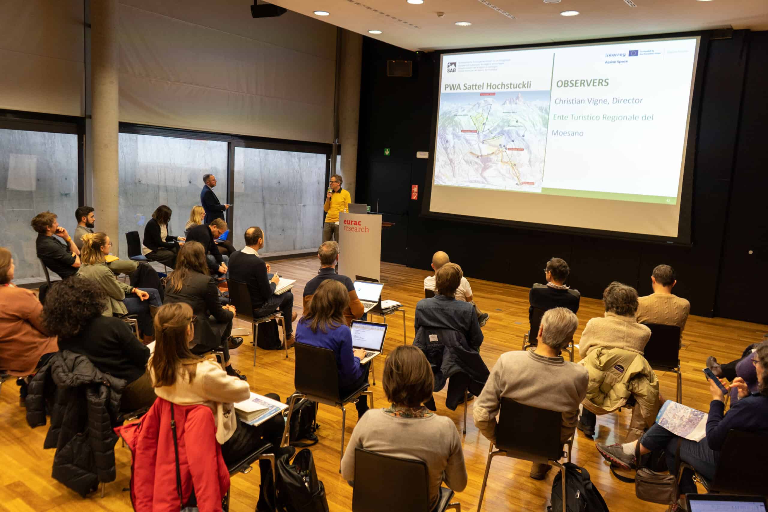
Thirteen Partners, each one with its expertise, presented their teams and pilot areas during the kick off meeting. Find out their names, objectives, traits of their territory and list of Observers for each Country. Learn also about key aspects of the project: BeyondSnow's goals, issues, expected outputs and deliverables.Download
-
A report from BeyondSnow project that provides an overview on the main effects of climate change on the Alpine Space small Snow Tourism Destinations currently affected or that will be affected in the future by lack of snow coverage.Download
-
La Fabrique des Transitions argues transition requires systemic change driven by vision and action. Examining testimonies from 62 French mountain territories, this report explores how communities experience and navigate climate disruptions, showcasing real-world challenges and opportunities for transformation.Download
-
Discover the Vulnerability Map, developed within the BeyondSnow project, and how it aims to explore the complexity of vulnerabilities in Alpine territories to climate change and provide a comprehensive overview that integrates both biophysical and socio-ecological and economic dimensions.Download
-
A BeyondSnow (activity A1.2) that aims at providing the partnership with a solid knowledge base regarding vulnerability and resilience in the context of tourism destinations. The report encompasses key vulnerability indicators of STDs used in the BeyondSnow project, theoretical definitions, and approaches of resilience of tourism destinations.Download
-
Analysis of models, approaches, and innovations to help STDs adapt to climate change, reducing vulnerability and boosting resilience.Download
-
This report offers an in-depth analysis of the tourism systems of the Pilot Working Areas of the Interreg - Alpine Space Project “BeyondSnow”.Download
-
Compendium illustrating the methodological basis of the RAM, its development, and its potential for positively influencing the socio-ecological CC resilience of Alpine STDs.Download
-
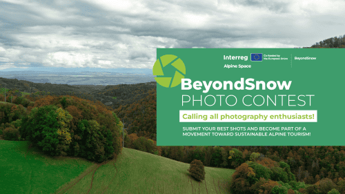
BeyondSnow Photo Contest - Terms and Conditions for participating in the BeyondSnow Photo Contest.Download
-
Memorandum of Understanding on long-term use, rights and obligations of RDMDT utilization during and after the project.Download
-
This BeyondSnow document provides a method for actively engaging communities and stakeholders in creating climate change adaptation strategies. Through participatory labs and inclusive processes, it aims to develop resilience and innovation in Alpine destinations.Download
-
This document provides an introduction to the Transition Strategies developed in the Pilot Working Areas (PWAs). It serves as a general overview and reference for the detailed reports published separately.Download
-
This report introduces the Transition Strategy developed for the Pilot Working Area of Piani d'Erna (Italy). It highlights local objectives, approaches and potential long-term impacts in strengthening climate resilience.Download
-
This report introduces the Transition Strategy developed for the Pilot Working Area of Monesi di Triora (Italy). It highlights local objectives, approaches and potential long-term impacts in strengthening climate resilience.Download
-
This report introduces the Transition Strategy developed for the Pilot Working Area of Ala di Stura & Balme (Italy). It highlights local objectives, approaches and potential long-term impacts in strengthening climate resilience.Download
-
This report introduces the Transition Strategy developed for the Pilot Working Area of Pradibosco (Italy). It highlights local objectives, approaches and potential long-term impacts in strengthening climate resilience.Download
-
This report introduces the Transition Strategy developed for the Pilot Working Werfenweng (Austria). It highlights local objectives, approaches and potential long-term impacts in strengthening climate resilience.Download
-
This report introduces the Transition Strategy developed for the Pilot Working Area of Bohinj (Slovenia). It highlights local objectives, approaches and potential long-term impacts in strengthening climate resilience.Download
-
This report introduces the Transition Strategy developed for the Pilot Working Area of Großer Arber (Germany). It highlights local objectives, approaches and potential long-term impacts in strengthening climate resilience.Download
-
This report introduces the Transition Strategy developed for the Pilot Working Area of Métabief (France). It highlights local objectives, approaches and potential long-term impacts in strengthening climate resilience.Download
-
This report introduces the Transition Strategy developed for the Pilot Working Area of Sattel Hochstuckli (Switzerland). It highlights local objectives, approaches and potential long-term impacts in strengthening climate resilience.Download
-
This report introduces the Transition Strategy developed for the Pilot Working Area of Balderschwang (Germany). It highlights local objectives, approaches and potential long-term impacts in strengthening climate resilience.Download
-
Knowledge base on pilot implementations, making recommendations for maintaining and multiplying the positive results achieved, facilitating their sustainability beyond the project conclusion.Download
-
Using text, infographics, photos and data visuals, the visual storytelling report illustrates details and highlights of the in-person capacity building events and recommendations.Download
-
BeyondSnow on Tour: a roadshow across the Alps raising awareness on climate change and new futures.Download
Project calendar